Point Reyes Station in Marin County, California — The American West (Pacific Coastal)
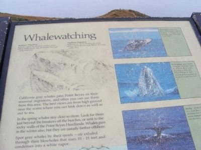
Whalewatching
Southern Migration
• Pass Point Reyes late December through early February.
Northern Migration
•Mexico to Artic feeding grounds
•Pass Point Reyes early March through early May.
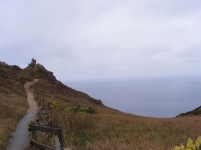
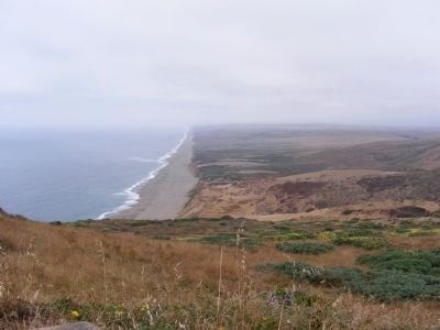
California gray whales pass Point Reyes on their seasonal migrations, and often you can see them from this area. The best views are from high ground near the water where you can look down as well as out to sea.
In the spring whales stay close to shore. Look for them just beyond the breakers off the beaches, or next to the rocky walls of the Point Reyes Headlands. Whales pass in the winter also, but they are usually farther offshore.
Spot gray whales by their spouts — air exhaled through their blowholes that rises 10-15 feet and condenses into a white vapor.
Erected by National Park Service.
Topics. This historical marker is listed in these topic lists: Animals • Environment.
Location. 37° 59.766′ N, 122° 58.71′ W. Marker is in Point Reyes Station, California, in Marin County. Marker can be reached from Chimney Rock Road. Marker is located in Point Reyes National Seashore. Touch for map. Marker is in this post office area: Point Reyes Station CA 94956, United States of America. Touch for directions.
Other nearby markers. At least 8 other markers are within 3 miles of this marker, measured as the crow flies. Sea Life in These Waters (here, next to this marker); Lives of Sacrifice and Service are Honored Here (within shouting distance of this marker); Victims of the Coast (within shouting distance of this marker); Francis Drake (about 500 feet away, measured in a direct line); Preserving Our Maritime Past (approx. 0.3 miles away); Point Reyes Conglomerate (approx. 2.3 miles away); Point Reyes Light Station (approx. 2.3 miles away); Common Murres (approx. 2.3 miles away).
Credits. This page was last revised on May 22, 2023. It was originally submitted on February 16, 2013, by Don Morfe of Baltimore, Maryland. This page has been viewed 460 times since then and 11 times this year. Photos: 1, 2, 3, 4. submitted on February 16, 2013, by Don Morfe of Baltimore, Maryland. 5. submitted on February 19, 2013, by Don Morfe of Baltimore, Maryland. • Syd Whittle was the editor who published this page.
Editor’s want-list for this marker. A full view of the marker. • Wide area view of the marker and its surroundings. • Can you help?


