
Dover in Stewart County, Tennessee — The American South (East South Central)
Holding the Outer Lines
Photographed by Craig Swain, September 4, 2010
1. Holding the Outer Lines Marker
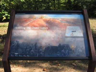
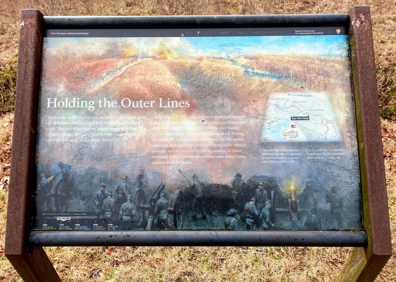
On February 13, 1862, when Union General McClernand tried to capture Capt. Frank Maney's four-gun Tennessee Battery on the ridge southeast of here, Graves' Battery was instrumental in thwarting the Federal attack. During this battle, the first major fighting between the two armies, exploding shells ignited dry leaves and brush below Maney's position, and the ensuing fire killed a number of Union wounded. A few Confederates rescued some of the Union soldiers from the flames.
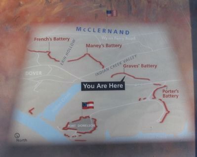
The outer line entrenchments, hurriedly built after the surrender of Fort Henry, ran in a broken semi-circle from Hickman Creek on the west to near the Cumberland River beyond the town of Dover on the east.
Erected by Fort Donelson National Battlefield - National Park Service - Department of the Interior.
Topics. This historical marker is listed in this
this page online
Location. 36° 28.884′ N, 87° 51.448′ W. Marker is in Dover, Tennessee, in Stewart County. It is on Park Road near Eddyville Road, on the right when traveling east. Located at Stop 7 on the driving tour of Fort Donelson National Battlefield. Touch for map. Marker is in this post office area: Dover TN 37058, United States of America. Touch for directions.

Regionally, this marker is in Middle Tennessee and in the Highland Rim. It is also in the American South and specifically in the Upper South. Globally, it is in North America, the Western Hemisphere, the Western World, and the Anglosphere. Historically, it finds itself in what was once the territory of the Mississippian Culture, one of the Confederate States of America, and the Antebellum South.
Other nearby markers. At least 8 other markers are within walking distance of this marker: Graves' Battery C.S.A. (here, next to this marker); Graves' Battery (within shouting distance of this marker); Forrest's Cavalry (approx. ¼ mile away); Confederate Trenches (approx. 0.3 miles away); 6-pounder Gun (approx.
Photographed by Shane Oliver, February 7, 2021
2. Holding the Outer Lines Marker
Other markers no longer nearby. Federal Troops and Casualties at Fort Donelson (was approx. 0.3 miles away but has been confirmed missing); Confederate Troops and Casualties at Fort Donelson (was approx. 0.3 miles away but has been confirmed missing); Fort Donelson (was approx. 0.3 miles away but has been confirmed missing).
Also see . . . Fort Donelson. National Park Service site. (Submitted on November 27, 2010, by Craig Swain of Leesburg, Virginia.)
Photographed by Craig Swain, September 4, 2010
3. Map of the Outer Fortifications
Photographed by Craig Swain, September 4, 2010
4. Holding the Outer Lines Marker
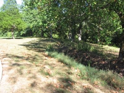
Photographed by Craig Swain, September 4, 2010
5. Confederate Outer Lines
Traces of the trench lines exist today.
Credits. This page was last revised on May 10, 2021. It was originally submitted on November 27, 2010, by Craig Swain of Leesburg, Virginia. This page has been viewed 828 times since then and 20 times this year. Last updated on February 18, 2013, by David Graff of Halifax, Nova Scotia. Photos: 1. submitted on November 27, 2010, by Craig Swain of Leesburg, Virginia. 2. submitted on May 10, 2021, by Shane Oliver of Richmond, Virginia. 3, 4, 5. submitted on November 27, 2010, by Craig Swain of Leesburg, Virginia.
