Los Banos in Merced County, California — The American West (Pacific Coastal)
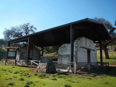
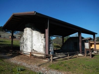
The Old Adobe of Rancho San Luis Gonzaga
Photographed By Barry Swackhamer
1. The Old Adobe of Rancho San Luis Gonzaga Marker
Photo captions:
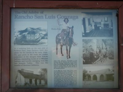
Old Adobe and Ranch House in the 1850s (top, left); Paula Fatjo (center); Interior after 1848 (top, right; Paula Fatjo and Dorzah pose near one of the gun ports (center, right). (Other captions not visible.)
Old Adobe and Ranch House in the 1850s (top, left); Paula Fatjo (center); Interior after 1848 (top, right; Paula Fatjo and Dorzah pose near one of the gun ports (center, right). (Other captions not visible.)
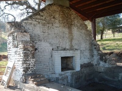
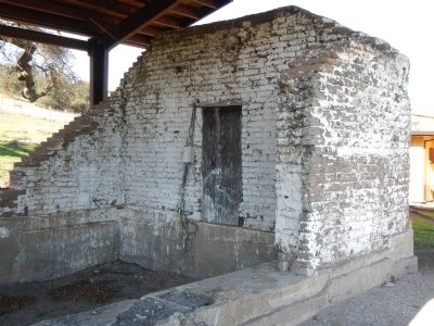
At a watering hole on the east side of Pacheco Pass, Juan Pacheco built this adobe for his rancho in the early 1840’s. The gun ports in the walls are visible reminders of the dangers from Yokuts Indians, marauding bands of ex-Mission Indians, and bandits emerging from the San Joaquin Valley. This was the frontier of Mexican California.
Paula Fatjo (fah-tcho), descendent of the Pachecos and the Malarins and heir to Rancho San Luis Gonzaga, restored the adobe as her home and ranching headquarters in 1948. A San Francisco society belle, she decided to return to the family rancho and live the life of her ranchero ancestors.
In the 1960s the Central Valley Water Project took about half the rancho, including the site of the ranch headquarters and the adobe. Paula built a new ranch headquarters here on the western portion of the rancho. But she wouldn't leave the old family adobe to be melted away by the flooding waters of the San Luis Reservoir. It was the oldest adobe in the San Joaquin Valley. She built new foundations at this location, and lifted the adobe structure onto a truck to be transported to this spot. Up the hill it came, but at the last moment the truck shuddered, and the side walls of the precarious adobe came tumbling down.
Topics. This historical marker is listed in these topic lists: Hispanic Americans • Settlements & Settlers. A significant historical year for this entry is 1948.
Location. 37° 3.609′ N, 121° 13.27′ W. Marker is in Los Banos, California, in Merced County. Marker can be reached from Whiskey Flat Road/Trail. The marker is located in Pacheco State Park. Whiskey Flat Road is unsigned on Highway 152. The road is gated and locked at the picnic grounds and you must walk 1/4-mile to the employee residences where the adobe is located. Touch for map. Marker is in this post office area: Los Banos CA 93635, United States of America. Touch for directions.
Other nearby markers. At least 8 other markers are within 9 miles of this marker, measured as the crow flies. 1843 - Rancho de San Luis Gonzaga - 1931 (here, next to this marker); Bell Station (approx. 5.2 miles away); Pacheco Pass (approx. 6.9 miles away); First Marine Division – FMF (approx. 8.7 miles away); Remember Pearl Harbor (approx. 8.7 miles away); The Remembrance Memorial for California Korean War Veterans (approx. 8.7 miles away); In Memory of Korean War Veterans (approx. 8.7 miles away); The Chosin Few (approx. 8.7 miles away).
Credits. This page was last revised on August 1, 2023. It was originally submitted on February 24, 2013, by Barry Swackhamer of Brentwood, California. This page has been viewed 1,641 times since then and 97 times this year. Last updated on July 27, 2023, by Ronald D. (Ron) Trigueiro of Fresno, California. Photos: 1, 2, 3, 4, 5. submitted on February 5, 2013, by Barry Swackhamer of Brentwood, California. • Devry Becker Jones was the editor who published this page.
