Shipley Hill in Baltimore, Maryland — The American Northeast (Mid-Atlantic)
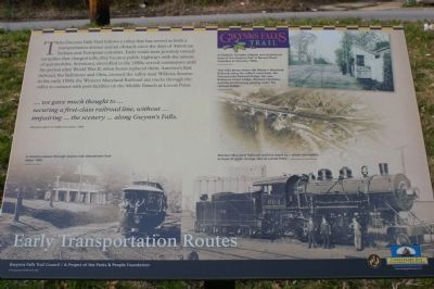
Early Transportation Routes
Photographed by Christopher Busta-Peck, March 17, 2008
1. Early Transportation Routes Marker
... we gave much thought to ... securing a first-class railroad line, without ... impairing ... the scenery ... along Gwynns Falls.
Olmsted report on Baltimore parks, 1904
[photograph]
A streetcar passes through Gwynn Oak Amusement Park about 1900.
[photograph]
A Frederick Turnpike tollgate was located just west of the Gwynns Falls at Mount Olivet Cemetery in the early 1900s.
[photograph]
This 1932 photograph shows the Western Maryland Railroad along the valley's west bank, the Pennsylvania
this page online
[photograph]
Western Maryland Railroad workers stand by a steam locomotive in front of grain storage silos at Locust Point.
Erected by Gwynns Falls Trail Council.
Topics and series. This historical marker is listed in these topic lists: Bridges & Viaducts • Railroads & Streetcars • Roads & Vehicles. In addition, it is included in the Maryland, Gwynns Falls Trail, and the Pennsylvania Railroad (PRR) series lists. A significant historical year for this entry is 1904.
Location. 39° 17.243′ N, 76° 39.741′ W. Marker is in Baltimore, Maryland. It is in Shipley Hill. It is at the intersection of West Baltimore Street and Ellicott Driveway, on the left when traveling west on West Baltimore Street. Note that while Ellicott Driveway still shows up as a road on many maps, it is not longer open to motorized vehicle traffic. Touch for map. Marker is in this post office area: Baltimore MD 21223, United States of America. Touch for directions.

Regionally, this marker is in Central Maryland. It is also in the American Mid-Atlantic, in the
Photographed by Christopher Busta-Peck, March 17, 2008
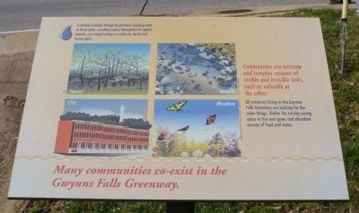
2. Additional sign describing local ecosystems
Other nearby markers. At least 8 other markers are within walking distance of this marker: Bridging Gwynns Falls (about 500 feet away, measured in a direct line); Gwynns Falls Park at Frederick Avenue (approx. 0.4 miles away); Ellicott Flour Mills (approx. 0.4 miles away); Gwynns Falls Valley (approx. 0.4 miles away); Rowhouses: a Baltimore Tradition (approx. half a mile away); Memorial to John E. Burbage (approx. half a mile away); Mt. Olivet Cemetery (approx. half a mile away); Early Industries (approx. 0.7 miles away). Touch for a list and map of all markers in Baltimore.
Also see . . . Gwynns Falls Trail Council. (Submitted on March 18, 2008, by Christopher Busta-Peck of Shaker Heights, Ohio.)
Photographed by Christopher Busta-Peck, March 17, 2008
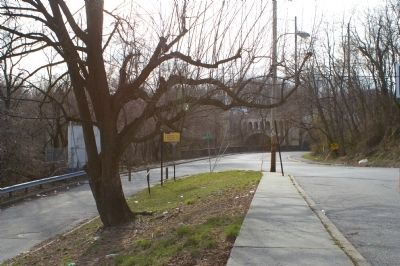
3. Location of markers, as seen looking west.
Photographed by Christopher Busta-Peck, March 17, 2008
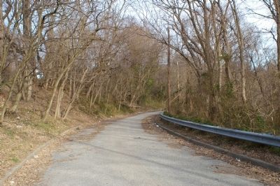
4. View south along the Ellicott Driveway
This is the route of the Gwynns Falls Trail - the road has been closed to vehicular traffic.
Photographed by Christopher Busta-Peck, March 17, 2008
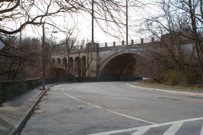
5. View north to the railroad bridge over Gwynns Falls
This bridge was used by the Pennsylvania Railroad and is now used by Amtrak.
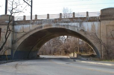
Photographed by Christopher Busta-Peck, March 17, 2008
6. View under the railroad bridge with "Bridging Gwynns Falls" marker in the distance
Note that cars tend to take these curves rather quickly, so exercise considerable caution if crossing the road here.
Credits. This page was last revised on March 3, 2025. It was originally submitted on March 18, 2008, by Christopher Busta-Peck of Shaker Heights, Ohio. This page has been viewed 2,372 times since then and 21 times this year. Photos: 1, 2, 3, 4, 5, 6. submitted on March 18, 2008, by Christopher Busta-Peck of Shaker Heights, Ohio.
