Fort Mason in San Francisco City and County, California — The American West (Pacific Coastal)
San Francisco Port of Embarkation (1932-1962)
Headquarters
Inscription.
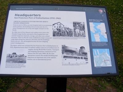
Critical Logistics Center for the Army’s Pacific Operations.
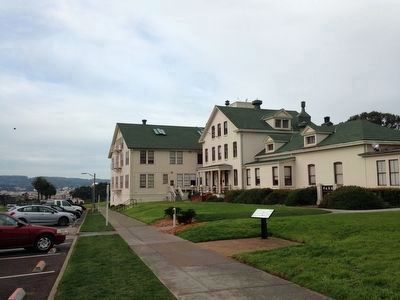
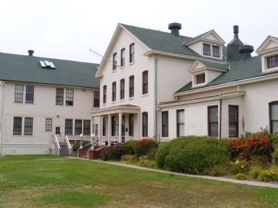
From its start in 1902 as an army hospital, built to accommodate twelve patients, this building went on to become the U. S. Army’s headquarters for troop and supply transport to the Pacific.
By 1906, most of Fort Mason’s sick soldiers were sent to the Presidio’s larger facility and much of the hospital here was used for temporary barracks, storage, and other non-critical functions. Then in 1912 the army established a major troop and cargo depot along Fort Mason’s shoreline and the building’s future was set—the old hospital became the new shipping center’s headquarters.
The depot, which was renamed the San Francisco Port of Embarkation in 1932, dispatched more than 1.6 million soldiers and over 23 million tons of supplies during World War II alone. Transport and shipping operations continued at Fort Mason into the early 1960s. By the time operations ceased, this modest building had long been an important site in the nation’s historic rise to international power.
Captions:
At times, celebration, ceremony, and high-ranking visitors like General Eisenhower were the order of the day at Fort Mason. But day in and day out, the men and women who worked in this building coordinated the movement of soldiers and supplies to and from the Pacific.
Vast numbers of soldiers shipped out for Pacific destinations from the San Francisco Port of Embarkation at Fort Mason.
After the earthquake and fire in 1906, this site at Fort Mason was one of several civilian emergency relief camps established by the army on military lands around San Francisco. Note the top of the post hospital building (today's park headquarters) above the tents.
Sidebar:
World War II U.S. Army Posts and Facilities
In addition to the Fort Mason warehouses and piers, the Port of Embarkation staff managed port activities at the Embarcadero, Alameda, and Benicia Piers; the Oakland Army Base; Emeryville Ordnance Shops, and other locations.
Erected by National Park Service, U.S. Department of the Interior.
Topics. This historical marker is listed in these topic lists: Forts and Castles • Science & Medicine • War, World II. A significant historical year for this entry is 1902.
Location. 37° 48.336′ N, 122° 25.686′ W. Marker is in San Francisco, California, in San Francisco City and County. It is in Fort Mason. Marker can be reached from MacArthur Avenue west of Franklin Street, on the right when traveling west. The marker is located at Fort Mason within the boundaries of the Golden Gate National Recreation Area. Touch for map
. Marker is in this post office area: San Francisco CA 94123, United States of America. Touch for directions.
Other nearby markers. At least 8 other markers are within walking distance of this marker. Phillip Burton (about 400 feet away, measured in a direct line); Golden Gate National Recreation Area Legislation (about 400 feet away); Fort Mason Historic District (about 600 feet away); San Francisco Port of Embarkation (about 700 feet away); Brigantine Galilee (approx. 0.2 miles away); Tubbs Cordage Building (approx. 0.2 miles away); a different marker also named Fort Mason Historic District (approx. 0.2 miles away); a different marker also named Fort Mason Historic District (approx. 0.2 miles away). Touch for a list and map of all markers in San Francisco.
Credits. This page was last revised on February 7, 2023. It was originally submitted on March 1, 2013, by Don Morfe of Baltimore, Maryland. This page has been viewed 694 times since then and 30 times this year. Photos: 1. submitted on March 1, 2013, by Don Morfe of Baltimore, Maryland. 2. submitted on December 1, 2015, by Jo Solorzano of San Francisco, California. 3, 4. submitted on March 1, 2013, by Don Morfe of Baltimore, Maryland. • Syd Whittle was the editor who published this page.


