Leesburg in Loudoun County, Virginia — The American South (Mid-Atlantic)
Edwards Ferry
An Eighty-Mile-Long Column
— Gettysburg Campaign —
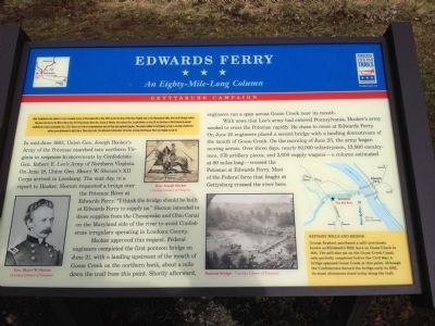
In mid-June 1863, Union Gen. Joseph Hooker's Army of the Potomac marched into northern Virginia in response to movements by Confederate Gen. Robert E. Lee's Army of Northern Virginia. On June 18, Union Gen. Henry W. Slocum's XII Corps arrived in Leesburg. The next day, in a report to Hooker, Slocum requested a bridge over the Potomac River at Edwards Ferry. "I think the bridge should be built at Edwards Ferry to supply us." Slocum intended to draw supplies from the Chesapeake and Ohio Canal on the Maryland side of the river to avoid Confederate irregulars operating in Loudoun County.
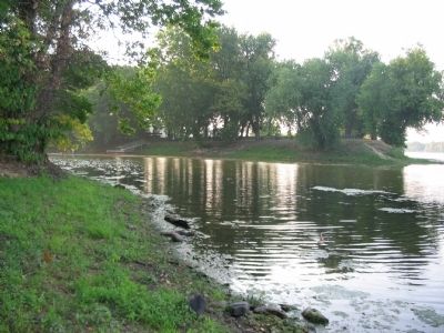
Hooker approved this request. Federal engineers completed the first pontoon bridge on June 21, with a landing upstream of the mouth of Goose Creek on the norther bank, about a mile down the trail from this point. Shortly afterward, engineers ran a span across Goose Creek near its mouth.
With news that Lee's army had entered Pennsylvania, Hooker needed to cross the Potomac rapidly. He chose to cross at Edwards Ferry. On June 25 engineers placed a second bridge with a landing downstream of the mouth of Goose Creek. On the morning of June 25, the army began moving across. Over three days, nearly 80,000 infantrymen, 12,000 cavalrymen, 370 artillery pieces, and 3,000 supply wagons - a column estimated at 80 miles long - crossed the Potomac at Edwards Ferry. Most of the Federal force that fought at Gettysburg crossed the river here.
(Sidebar): Kephart Mills and Bridge
George Kephart purchased a mill (previously known as Elizabeth's Mill) here on Goose Creek in 1841. The mill also sat on the Goose Creek Canal, only partially completed before the Civil War. A bridge spanned Goose Creek at this point. Although the Confederates burned the bridge early in 1862, its stone abutments still stand today along the trail.
Erected 2013 by Virginia Civil War Trails.
Topics and series. This historical marker is listed in this topic list: War, US Civil. In addition, it is included in the Chesapeake and Ohio (C&O) Canal, and the Virginia Civil War Trails series lists. A significant historical month for this entry is May 1863.
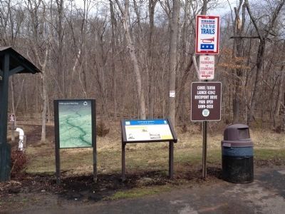
Location. 39° 5.91′ N, 77° 29.67′ W. Marker is in Leesburg, Virginia, in Loudoun County. Marker can be reached from Riverpoint Drive, on the left when traveling east. The marker is located in the Kephart Bridge Landing at Elizabeth Mills Riverfront Park. Touch for map. Marker is in this post office area: Leesburg VA 20176, United States of America. Touch for directions.
Other nearby markers. At least 8 other markers are within 2 miles of this marker, measured as the crow flies. A different marker also named Edwards Ferry (approx. 1.2 miles away in Maryland); At the Junction of War and Peace: (approx. 1.2 miles away in Maryland); Ice House (approx. 1.2 miles away); Carriage House (approx. 1.3 miles away); a different marker also named Edward’s Ferry (approx. 1.3 miles away in Maryland); Red Rock Wilderness Overlook Regional Park (approx. 1.3 miles away); Two-Chambered Granary (approx. 1.3 miles away); Well House (approx. 1.3 miles away). Touch for a list and map of all markers in Leesburg.
Also see . . . The Edwards Ferry Crossing. A collection of blog posts detailing the crossing. (Submitted on March 13, 2013, by Craig Swain of Leesburg, Virginia.)
Credits. This page was last revised on June 16, 2016. It was originally submitted on March 13, 2013, by Craig Swain of Leesburg, Virginia. This page has been viewed 1,852 times since then and 72 times this year. Photos: 1. submitted on March 13, 2013, by Craig Swain of Leesburg, Virginia. 2. submitted on April 6, 2013, by Craig Swain of Leesburg, Virginia. 3, 4. submitted on March 13, 2013, by Craig Swain of Leesburg, Virginia.


