Lucerne Valley in San Bernardino County, California — The American West (Pacific Coastal)
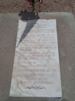
Peter Davidson
Photographed by Richard Hawkins, March 27, 2013
1. Peter Davidson Marker
Peter Davidson
He died, unmarried, Jan. 17, 1908 at the age of 82. His grave is 30 or 40 feet north.
Erected 1981 by Apple Valley Optimist Club & Lucerne Valley Chamber of Commerce.
Topics. This historical marker is listed in these topic lists: Cemeteries & Burial Sites • Settlements & Settlers. A significant historical date for this entry is January 17, 1867.
Location. 34° 27.496′ N, 116° 58.05′ W. Marker is in Lucerne Valley, California, in San Bernardino County. It is at the intersection of Kendall Road and Rabbit Springs Road, on the right when traveling north on Kendall Road. Touch for map. Marker is at or near this postal address: 11300 Kendall Road, Lucerne Valley CA 92356, United States of America. Touch for directions.

Regionally, this marker is in Greater Los Angeles, in the Peninsular Ranges, and specifically in the Transverse Ranges. It is also in the American Southwest. Globally, it is in North
this page online
Other nearby markers. At least 8 other markers are within 15 miles of this marker, measured as the crow flies: Chimney Rock (approx. 2.2 miles away); The Last Indian Fight in Southern California (approx. 2.2 miles away); People Came and Left This Meadow (approx. 11.8 miles away); Bellevill Holcomb Valley (approx. 11.8 miles away); The Pigmy Cabin (approx. 11.9 miles away); Big Bear Solar Observatory (approx. 13.9 miles away); Big Bear Valley (approx. 14.1 miles away); Woodland Club Caddy Shack (approx. 15.1 miles away). Touch for a list and map of all markers in Lucerne Valley.
Another marker is no longer nearby. Holcomb Valley (was approx. 11.8 miles away but has been confirmed missing).
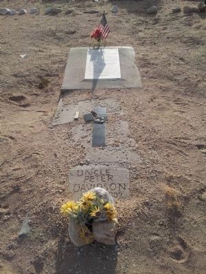
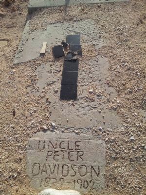
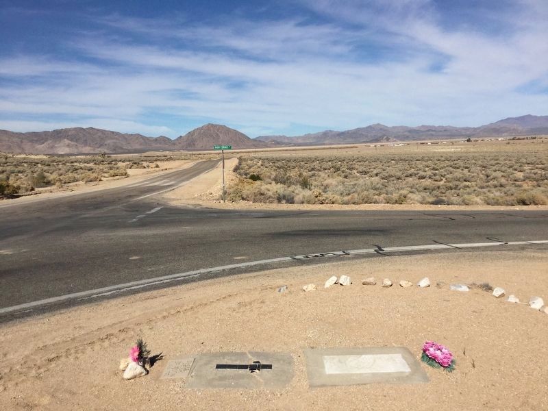
More about this marker. Peter Davidson's kept a weigh station for wagon trains. The actual grave lies under the road, but the headstone and site are located on the nearest corner.
Source: Lacerne Valley Points of Interest - http://www.lvcal.org/chamber/points.htm
Photographed by Richard Hawkins, March 27, 2013
2. Peter Davidson Marker
Photographed by Richard Hawkins, March 27, 2013
3. Peter Davidson Marker
Photographed by Craig Baker, November 3, 2018
4. View Looking North
The original grave site is in the middle of the road.
Credits. This page was last revised on November 7, 2018. It was originally submitted on March 27, 2013, by Richard Hawkins of Phelan, California. This page has been viewed 1,203 times since then and 38 times this year. Photos: 1, 2, 3. submitted on March 27, 2013, by Richard Hawkins of Phelan, California. 4. submitted on November 4, 2018, by Craig Baker of Sylmar, California. • Syd Whittle was the editor who published this page.
