Coalinga in Fresno County, California — The American West (Pacific Coastal)
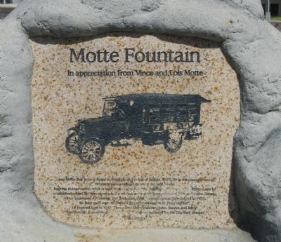
Motte Fountain
In appreciation from Vince and Lois Motte
Photographed by Barry Swackhamer, March 22, 2013
1. Motte Fountain Marker
Vince Motte was born at home in Coalinga on the 6th of August, 1913. He is the youngest son of Westside pioneers Baptiste and Josephine Motte. Baptiste homesteaded, what is now Motte Canyon in the Jacalitos Hills south of Coalinga. Later he established a food delivery service and a market at the northwest corner of Fith and Cedar Streets. Vince was raised in Coalinga and graduated from Coalinga Union High School in 1933. He later took over his father’s grocery business, B.M. Food Market. He married Lois in 1946. They raised three children, John, Sandra, and Barry.
This fountain is an expression of their love and appreciation for the City they cherish.
Topics. This historical marker is listed in these topic lists: Industry & Commerce • Roads & Vehicles. A significant historical year for this entry is 1913.
Location. 36° 8.615′ N, 120° 21.824′ W. Marker is in Coalinga, California, in Fresno County. It is at the intersection of Van Ness Street and Sunset Avenue, on the left when traveling west on Van Ness Street. Motte Fountain is located in a small park formed by Sunset Avenue, Van Street and Ash
this page online

Regionally, this marker is in the San Joaquin Valley, specifically in the Central Valley, and in the Sierra Nevada. It is also on the American Pacific Coast. Globally, it is in North America, on the Ring of Fire, on the Pacific Rim, in the Western Hemisphere, in the Western World, and in the Anglosphere. Historically, it finds itself in what was once New Spain and also Mexico’s Alta California.
Other nearby markers. At least 8 other markers are within walking distance of this marker: Coalinga Union High School (within shouting distance of this marker); Grammar School (about 500 feet away, measured in a direct line); St. Paul’s Catholic Church (about 600 feet away); “Dr. Bill” (approx. 0.2 miles away); The Phelps Building (approx. 0.2 miles away); B.M. Food Market (approx. 0.2 miles away); Liberty “Airdome Theater” (approx. 0.2 miles away); The Bertrich Block (approx. 0.2 miles away). Touch for a list and map of all markers in Coalinga.
Photographed by Barry Swackhamer, March 22, 2013
2. Motte Fountain
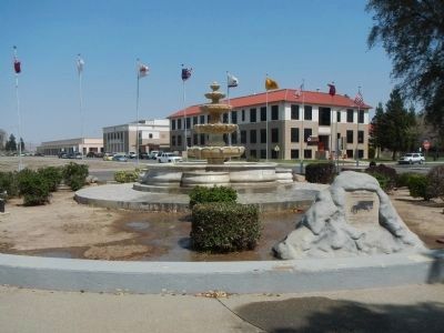
Coalinga Union High School is visible in the background.
Credits. This page was last revised on August 17, 2020. It was originally submitted on March 31, 2013, by Barry Swackhamer of Brentwood, California. This page has been viewed 933 times since then and 31 times this year. Photos: 1, 2. submitted on March 31, 2013, by Barry Swackhamer of Brentwood, California. • Syd Whittle was the editor who published this page.
