Near Concord in Appomattox County, Virginia — The American South (Mid-Atlantic)
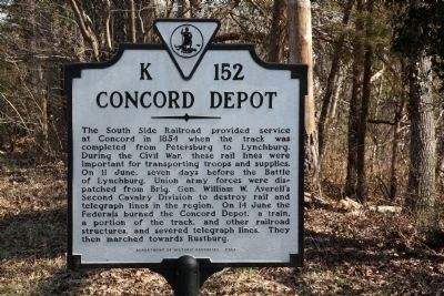
Concord Depot
Erected 2003 by Department of Historic Resources. (Marker Number K-152.)
Topics and series. This historical marker is listed in this topic list: War, US Civil. In addition, it is included in the Virginia Department of Historic Resources (DHR) series list. A significant historical year for this entry is 1854.
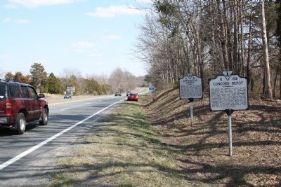
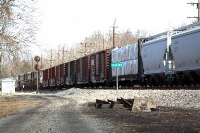
Location. 37° 20.965′ N, 78° 58.298′ W. Marker is near Concord, Virginia, in Appomattox County. Marker is on Richmond Highway (U.S. 460) just east of Village Highway (Virginia Route 24), on the right when traveling east. It is at the Campbell County line. Touch for map. Marker is in this post office area: Concord VA 24538, United States of America. Touch for directions.
Other nearby markers. At least 8 other markers are within 8 miles of this marker, measured as the crow flies. Appomattox County / Campbell County (a few steps from this marker); Oxford Furnace (approx. 4.3 miles away); Col. Vincent W. “Squeek” Burnett (approx. 5.3 miles away); Mount Athos (approx. 5.8 miles away); Surrender at Appomattox (approx. 6.3 miles away); The Last Fight (approx. 6.3 miles away); Buffalo Lick Plantation (approx. 6.9 miles away); Robertson House Fight (approx. 7.2 miles away).
More about this marker. This marker replaced a marker with the same name and title, but located at the old Route 460 alignment in Concord in Campbell County. It read “The first railroad train passed this station in 1854. In 1864, the station building and the Confederate commissary here were burned by the Union General Hunter.This was the extreme eastern limit of Hunter’s raid.”
Regarding Concord Depot. The June 11th and June 14th dates mentioned on the marker were in 1864.
Also see . . .
1. Hunter’s Operations.; Gen. Hunter’s Order. Mosby Retaliates. A Raid on the South-Side Railroad. 1864 New York Times article reprinting the Petersburgh Express. “Through the telegraph operator at Spout Creek, we learned at an early hour yesterday, that Concord Station, on the South-Side Railroad, twelve miles this side of Lynchburgh, was visited by a band of Yankee raiders on Monday night at 12 o'clock. They numbered about 150, came clad in Confederate uniform, and represented themselves on entering the place as a portion of Gen. IMBODEN’s command. Their acts, however, soon gave the lie to their words, as they proceeded to burn the depot, tear up the track, and destroy the little Government property in the vicinity. They cut down two or three telegraph poles, and destroyed but a few feet of wire. They left before the dawn of day, proceeding in the direction of Lynchburgh, from whence they came. The damage was repaired in a few hours, so far as the telegraph is concerned, and the other damage can and will be repaired to-day.” (Submitted on March 31, 2013.)
2. Southside Railroad. Wikipedia
entry. “The Southside Railroad from Petersburg west was a vital resource for the Confederacy as a supply line for Richmond and Petersburg during the American Civil War (1861–1865). Beyond the lines of battle until the war's last year, the principal damage it suffered was the financial weakness caused by Confederate compensation policies and currency. During the last year of the war, considerable damage was inflicted by both sides until the conflict finally ended near Appomattox Station on the Southside Railroad at Appomattox Courthouse in April 1865.” (Submitted on March 31, 2013.)
Credits. This page was last revised on June 16, 2016. It was originally submitted on March 31, 2013, by J. J. Prats of Powell, Ohio. This page has been viewed 1,448 times since then and 53 times this year. Photos: 1, 2, 3. submitted on March 31, 2013, by J. J. Prats of Powell, Ohio.


