Belle and Mayo Islands in Richmond, Virginia — The American South (Mid-Atlantic)
Belle Isle Hydro Plant
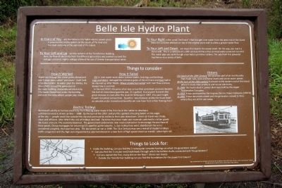
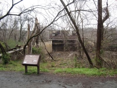
To your left and up are the remains of the Transformer Building. Here the flow of electricity from the different generators was evened-out and the voltage increased. Higher voltage allowed the use of thinner transportation wires.
To your right is the canal (“mill race”) that brought river water from the west end of the island. Note the concrete addition on top of the original stone wall to allow greater water flow.
To your left and down are steps that lead to the power plant. On the way, you reach a stone wall. This is a remnant of a 19th century millrace that serviced water-powered iron mill. The metal pipe you walk through once held a primitive turbine. The axle from this powered machinery via a series of belts.
Things to consider:
How it worked
Water ran through the metal grates ahead and into 3 large pipes called “penstocks”. Each held a fan-like turbine. As water Spun the baldes, the drive shafts turned the generators in the main building and produced electricity. (The water flowed out under the building and onto the rocks wher people play today).
How it failed
Silt in river water wore down turbine blades, bearings and bushings. Logs and debris damaged the entrance gates of the mill race and mud had to be cleaned up after floods. Power production varied with river flow and was always low in summer.
In the mid 1950’s the price of oil was so low that petroleum products became the fuel of choice (local gasoline was .25 a gallon). Had anyone foreseen the great increase in costs after the Arab Oil Embargo in 1967, this plant might have remained competitive. Question: would power production have been as valuable as the recreational benefits we now have from a free flowing river?
History
For much of the 19th century this land was part of an iron foundry that made nails, wire and horse shoes and ran on water power.
At the turn of the 20th century it moved to the eastern end of the island where it made steel products and ran on electricity.
In 1904 this hydroelectric power plant was built by the Upper Appomattox Company.
In 1925 it was purchased by the Virginia Electric Power Company (VEPCO)
In 1963 it was decommissioned and the generators moved to Peru where they are still in use today.
Electric Trolleys
Richmond’s ability to harness electricity from flowing water made it the first city in the nation to develop a commercial electric street car line--- 1888. By the turn of the 20th century this sparked a housing boom on the edges of the city --- people could live outside the city and commute by trolley to their jobs downtown. Street car travel was cheap, clean and efficient. After WW II the role of trolleys declined. Factories that once made war materials switched to civilian goods like buses and cars. The economy boomed. The government underwrote new road construction to encourage the purchase of these goods. Cheap mortgages for returning GI’s opened up the suburbs. Urban trolley lines were abandoned - the wires considered unsightly, the travel too slow. The last street car ran in 1949. The 21st century may see a revival of modern trolleys. Traffic congestion and the high cost of gasoline has spurred interest in a new form of high speed street car transit: urban light rail.
Things to look for:
• Inside the building, can you find the 3 rectangular concrete footings on which the generators rested?
• Can you find the 3 circular metal bulkheads through which the turbine shafts connected with the generators?
• Can you explain the fine, crusty dirt on the floor? (think river levels)
• Outside the Transformer building can you find the foundations for the power line towers?
Sign researched and initially written by the students in the VCU class “Issues in the Community” (2011)
Funded by Friends of the James River Park System
Erected by James River Park System.
Topics. This historical marker is listed in these topic lists: Industry & Commerce • Railroads & Streetcars. A significant historical year for this entry is 1967.
Location. 37° 31.676′ N, 77° 27.255′ W. Marker is in Richmond, Virginia. It is in Belle and Mayo Islands. Marker can be reached from Tredegar Street, 0.3 miles west of South 5th Street. Located on Belle Isle which can be reached via a pedestrian bridge from the north bank of the river. Touch for map. Marker is at or near this postal address: 470 Tredegar Street, Richmond VA 23219, United States of America. Touch for directions.
Other nearby markers. At least 8 other markers are within walking distance of this marker. Quarry Equipment (about 500 feet away, measured in a direct line); Quarry Pond (about 600 feet away); Headgate (about 600 feet away); Headgate Cleaner (about 700 feet away); Hollywood Rapids (about 800 feet away); Gun Emplacement (about 800 feet away); Belle Isle Rolling Milling and Slitting Manufactory (about 800 feet away); First Break Rapids (approx. 0.2 miles away). Touch for a list and map of all markers in Richmond.
Credits. This page was last revised on February 1, 2023. It was originally submitted on April 1, 2013, by Bernard Fisher of Richmond, Virginia. This page has been viewed 2,637 times since then and 370 times this year. Photos: 1, 2. submitted on April 1, 2013, by Bernard Fisher of Richmond, Virginia.

