Near Sharpsburg in Washington County, Maryland — The American Northeast (Mid-Atlantic)
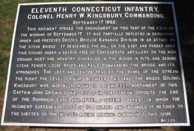
Eleventh Connecticut Infantry
Colonel Henry W. Kingsbury, Commanding,
September 17, 1862.
This regiment opened the engagement on this part of the field on the morning of September 17. It was partially deployed in skirmishing order and preceded Crook's Brigade, Kanawha Division, in an attack on the stone bridge. It descended the hill on the east and passed over this ground under a severe fire of Confederate artillery on the high ground west and infantry concealed in the woods, in pits, and behind stone fences, loose rocks and rails commanding the bridge and its approaches. The left and center reached banks of the stream. The right, the level ground between this and the bridge. Colonel Kingsbury was mortally wounded a few feet northwest of this. Captain John Griswold was killed in the stream opposite the end of the Rohrbach Lane, and after a severe contest in which the regiment suffered a loss of 139 killed and wounded, it retired to the shelter of the wooded ravine running north past this spur.
Erected by Antietam Battlefield Board. (Marker Number 123.)
Topics and series. This historical marker is listed in this topic list: War, US Civil. In addition, it is included in the Antietam Campaign War Department Markers series list. A significant historical month for this entry is September 1912.
Location. 39° 27.015′ N, 77° 43.777′ W. Marker is near Sharpsburg, Maryland, in Washington County. Marker can be reached from Burnside Bridge Road, on the right when traveling east. Located to the east of stop 9 (Burnside Bridge) of the driving tour of Antietam Battlefield. Touch for map. Marker is in this post office area: Sharpsburg MD 21782, United States of America. Touch for directions.
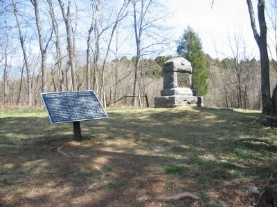
Other nearby markers. At least 8 other markers are within walking distance of this marker. 11th Connecticut Volunteer Infantry (a few steps from this marker); Ninth Army Corps (within shouting distance of this marker); U.S. Geological Survey Streamflow-Gaging Station (about 300 feet away, measured in a direct line); As the Georgians Saw It (about 500 feet away); a different marker also named Ninth Army Corps (about 500 feet away); Sturgis's Division, Ninth Army Corps (about 500 feet away); Fifty-First New York Infantry (about 500 feet away); a different marker also named Ninth Army Corps (about 500 feet away). Touch for a list and map of all markers in Sharpsburg.
Also see . . .
1. Antietam Battlefield. National Park Service site. (Submitted on March 20, 2008, by Craig Swain of Leesburg, Virginia.)
2. 11th Connecticut, 2nd Brigade, 3rd Division, IX Corps. Colonel Kingsbury was actually wounded four times, the last mortal. He would die on September 18, 1862. (Submitted on March 20, 2008, by Craig Swain of Leesburg, Virginia.)

Photographed By Craig Swain, September 17, 2007
3. Assault of the Eleventh Connecticut
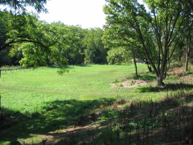
From the marker location looking southwest, with the east end of the Burnside Bridge seen through the trees on the right. The Regiment moved down the slopes here but was unable to press forward to the bridge due to heavy Confederate fire.
Credits. This page was last revised on September 29, 2017. It was originally submitted on March 20, 2008, by Craig Swain of Leesburg, Virginia. This page has been viewed 1,030 times since then and 10 times this year. Photos: 1. submitted on March 20, 2008, by Craig Swain of Leesburg, Virginia. 2. submitted on April 1, 2008, by Craig Swain of Leesburg, Virginia. 3. submitted on March 20, 2008, by Craig Swain of Leesburg, Virginia.

