Pawnee Rock Township in Barton County, Kansas — The American Midwest (Upper Plains)
Nehemiah Carson
1826 - 1846
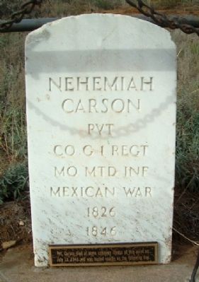
Photographed by William Fischer, Jr., November 9, 2012
1. Nehemiah Carson Marker
Company G 1st Regiment
Missouri Mounted Infantry
Mexican War
Pvt Carson died of some unknown illness
at this point on July 13, 1846
and was buried on the following day
Topics. This memorial is listed in these topic lists: Cemeteries & Burial Sites • War, Mexican-American.
Location. 38° 16.323′ N, 98° 58.897′ W. Memorial is in Pawnee Rock, Kansas, in Barton County. It is in Pawnee Rock Township. It is on North Centre Street. Marker is near the east face of Pawnee Rock, at Pawnee Rock State Historical Site, off SW 112th Avenue/Center Street. Touch for map. Memorial is at or near this postal address: 625 N Centre St, Pawnee Rock KS 67567, United States of America. Touch for directions.

Regionally, this memorial is in Central Kansas. It is also in the American Midwest, in the Corn Belt, on the prairies, on the Southern Plains, and on the Santa Fe Trail Corridor. Globally, it is in North America, the Western Hemisphere, the Western World, and the Anglosphere. Historically, it finds itself in what was once the Louisiana Purchase.
Other nearby markers. At
this page online
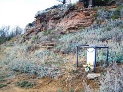
Photographed by William Fischer, Jr., November 9, 2012
2. Nehemiah Carson Marker
Credits. This page was last revised on September 1, 2020. It was originally submitted on April 6, 2013, by William Fischer, Jr. of Reynoldsburg, Ohio. This page has been viewed 859 times since then and 42 times this year. Photos: 1, 2. submitted on April 6, 2013, by William Fischer, Jr. of Reynoldsburg, Ohio.
