Pawnee Rock in Barton County, Kansas — The American Midwest (Upper Plains)
Marking the Rock
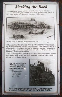
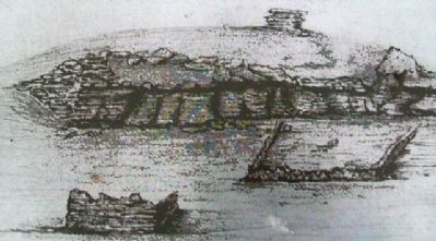
Pawnee Rock changed very little for ten thousand years. The hill was grass-covered with a fifty-foot-high face on the southeast side in front of you. Wind, water, and vegetation slowly eroded the stone.
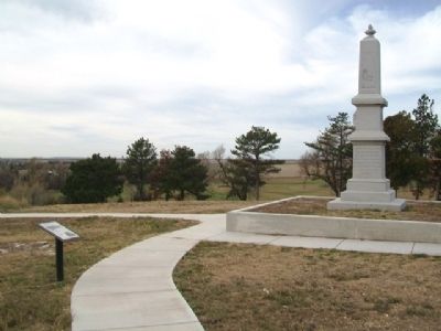
But Pawnee Rock has changed. The top of Pawnee Rock once was as high as the observation platform on top of the stone shelter behind you. In the late 1800s this site was quarried for building materials. Trees and the road to the top have been added. At the rim of the rock cannon barrels once rested on two concrete bases.
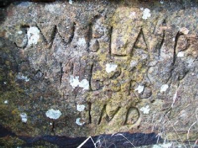
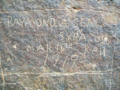
People have enjoyed the vistas from Pawnee Rock for thousands of years. Only recently have we left our mark. Hundreds of people have carved their names into the sandstone.
I cut my name, among the many hundreds inscribed on the rock and many of whom I knew.
Susan Magoffin, Traveler on the Santa Fe Trail
July 4, 1846
Some of these carvings are historic and need to be protected. PLEASE DO NOT DEFACE THE ROCK.
Erected by Kansas State Historical Society.
Topics and series. This historical marker is listed in these topic lists: Natural Features • Roads & Vehicles. In addition, it is included in the Santa Fe Trail series list. A significant historical month for this entry is July 1839.
Location. 38° 16.327′ N, 98° 58.927′ W. Marker is in Pawnee Rock, Kansas, in Barton County. Marker is along the walking path atop Pawnee Rock, at Pawnee Rock State Historical Site, off SW 112th Avenue/Center Street. Touch for map. Marker is in this post office area: Pawnee Rock KS 67567, United States of America. Touch for directions.
Other nearby markers. At least 8 other markers are within walking distance of this marker. Santa Fe Trail Monument (a few steps from this marker); “One of the Grandest Sights Ever Beheld” (a few steps from this marker); a different marker also named “One of the Grandest Sights Ever Beheld” (a few steps from this marker); "A Rallying Point for the Indians" (a few steps from this marker); "Along Came the Line of Wagons" (within shouting distance of this marker); "A Point of Red Rocks" (within shouting distance of this marker); Santa Fe Trail (within shouting distance of this marker); William Becknell (within shouting distance of this marker). Touch for a list and map of all markers in Pawnee Rock.
Also see . . .
1. Santa Fe National Historic Trail. (Submitted on April 7, 2013, by William Fischer, Jr. of Scranton, Pennsylvania.)
2. Santa Fe Trail Association. (Submitted on April 7, 2013, by William Fischer, Jr. of Scranton, Pennsylvania.)
3. Pawnee Rock State Historic Site, Kansas. (Submitted on April 7, 2013, by William Fischer, Jr. of Scranton, Pennsylvania.)
Credits. This page was last revised on August 31, 2020. It was originally submitted on April 7, 2013, by William Fischer, Jr. of Scranton, Pennsylvania. This page has been viewed 602 times since then and 21 times this year. Photos: 1, 2, 3, 4, 5. submitted on April 7, 2013, by William Fischer, Jr. of Scranton, Pennsylvania.
