Turner's Creek Landing in Kent County, Maryland — The American Northeast (Mid-Atlantic)
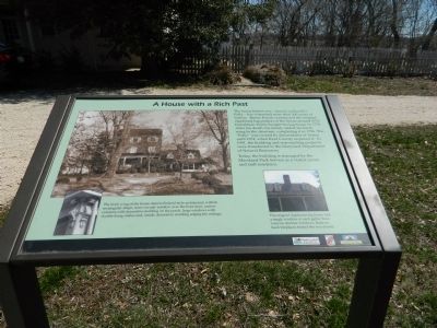
A Home with a Rich Past
Photographed by Beverly Pfingsten, April 6, 2013
1. A Home with a Rich Past Marker
Today, the building is managed by the Maryland Park Service as a visitor center and staff residence.
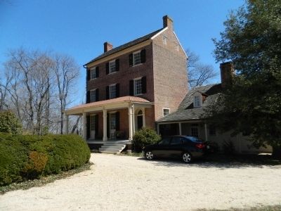
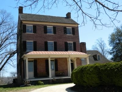
The brick wing of the house depicts Federal-style architecture with its rectangular shape, semi-circular window over the front door, narrow columns with decorative molding on the porch, large windows with double-hung sashes and, inside, decorative molding edging the ceilings.
The original clapboard log house had a single window in each gable; there were no dormer windows. Back-to-back fireplaces heated the two rooms.
Erected by Chesapeake Bay Gateways Network.
Topics. This historical marker is listed in
this page online
Location. 39° 21.276′ N, 75° 59.079′ W. Marker is in Turner's Creek Landing, Maryland, in Kent County. It can be reached from Turners Creek Road. Marker is on the grounds of Knock's Folly. Touch for map. Marker is in this post office area: Kennedyville MD 21645, United States of America. Touch for directions.

Regionally, this marker is on the Eastern Shore. It is also in the American Mid-Atlantic, on the Delmarva Peninsula, in the Tidewater, in the Chesapeake Bay Region, and on the Eastern Seaboard. Globally, it is in the North Atlantic Region, North America, the Western Hemisphere, the Western World, and the Anglosphere. Historically, it finds itself in what was once one of the original Thirteen Colonies and also the Antebellum South.
Other nearby markers. At least 8 other markers are within walking distance of this marker: Captain John Smith on the Sassafras River (a few steps from this marker); Natural Diversity at Turner's Creek (a few steps from this marker); The Tockwogh and the Bay (a few steps from this marker);
Photographed by Beverly Pfingsten, April 6, 2013
2. Knock's Folly
Photographed by Beverly Pfingsten, April 6, 2013
3. Knock's Folly
Photographed by Beverly Pfingsten, April 6, 2013
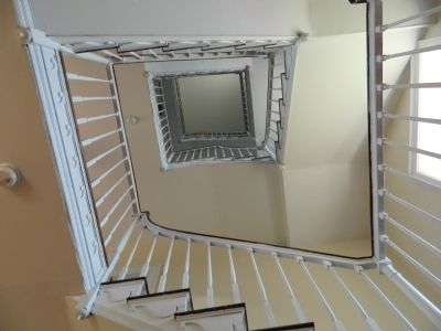
4. Knock's Folly Stairway
Credits. This page was last revised on June 16, 2016. It was originally submitted on April 12, 2013, by Bill Pfingsten of Bel Air, Maryland. This page has been viewed 1,409 times since then and 109 times this year. Photos: 1, 2, 3, 4. submitted on April 12, 2013, by Bill Pfingsten of Bel Air, Maryland.
