Near Strasburg in Shenandoah County, Virginia — The American South (Mid-Atlantic)
Cedar Creek
Strategic Crossing
— 1862 Valley Campaign —
Inscription.
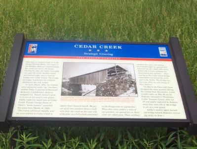
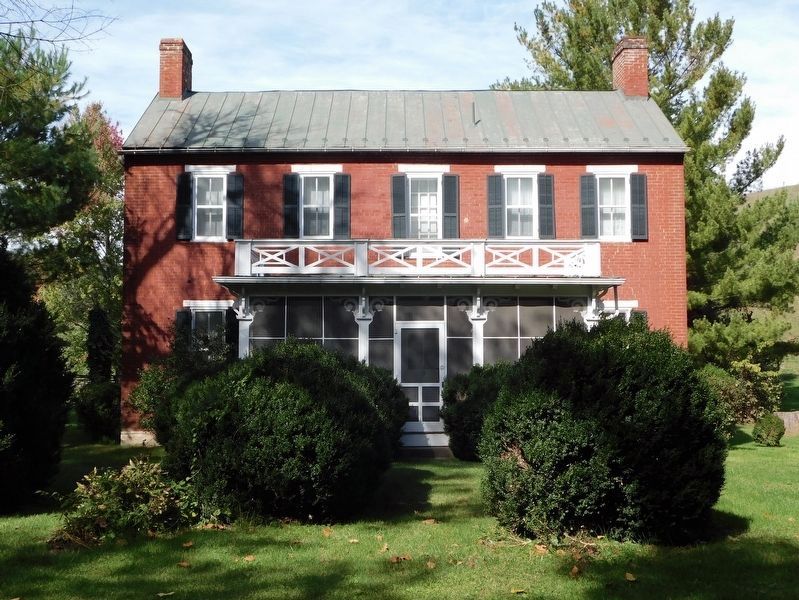
Just west of modern route 11 is the Daniel Stickley Farm. The ruins of the Stickley Mills are located beside the creek just below the house. During the war, the Valley Turnpike ran past the brick Stickley house and turned right onto a covered bridge over Cedar Creek. The bridge no longer stands but the original abutments are still visible.
In early March 1862, the Federal army advanced south “up” the Shenandoah Valley in pursuit of Stonewall Jackson’s Confederates. Jackson assigned Col. Turner Ashby’s cavalry to act as his army’s rear guard. Ashby made his stand here at Cedar Creek. Private George Neese of Chew’s “horse battery” recorded the scene here March 18, 1862: “The enemy advanced rapidly and we were ordered to Cedar Creek to oppose their onward march. We put our guns into position about a half mile from the creek on the west side of the pike, on a hill which commanded the bridge and its approaches... When they came within a mile of our position, we opened fire on them with our rifled guns. Their artillery wheeled four guns into battery immediately after we opened and returned our fire. Both sides thundered with a lively exchange for about twenty-five minutes.... Our men burnt the Cedar Creek bridge today before we turned the creek over to the Yanks. The bridge was burning when we were firing on their battery.”
On March 24, Chew and Neese occupied the same position during the retreat from Kernstown. A few months later, on May 24, as the Federals retreated to Winchester, Collis’ Zouaves (Union) were cut off and nearly captured by Jackson when they were left at the bridge to act as a rear guard.
Ashby’s cavalry again burned the bridge behind Jackson’s retreating army on June 1.
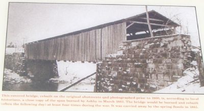
(Picture Caption) This covered bridge, rebuilt on the original abutments and photographed prior to 1900, is, according to local historians, a close copy of the span burned by Ashby in March 1862. The bridge would be burned and rebuilt (often the following day) at least four times during the war. It was carried away by the spring floods in 1865.
Erected by Virginia Civil War Trails.
Topics and series. This historical marker is listed in this topic list: War, US Civil. In addition, it is included in the Virginia Civil War Trails series list. A significant historical year for this entry is 1862.
Location. 39° 0.421′ N, 78° 19.163′ W. Marker is near Strasburg, Virginia, in Shenandoah County. Marker is on Valley Pike (U.S. 11) 0.4 miles north of Quarry Road, in the median. Located in the median between the north and southbound lanes of US 11. Touch for map. Marker is in this post office area: Strasburg VA 22657, United States of America. Touch for directions.
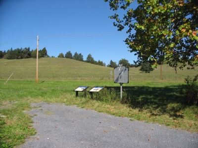
Other nearby markers. At least 5 other markers are within walking distance of this marker. A different marker also named Cedar Creek (here, next to this marker); Fort Bowman (here, next to this marker); Frederick County / Shenandoah County (approx. 0.2 miles away); Samuel Kercheval (approx. half a mile away); 128th Regt N.Y.S.V.I. (approx. half a mile away). Touch for a list and map of all markers in Strasburg.
Photographed By Craig Swain, September 29, 2007
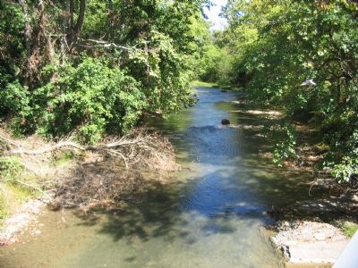
6. Cedar Creek
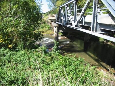
While not posing as an involved crossing as larger rivers in the area, the grade down to the creek was significant enough to limit traffic. During the 1864 battle of Cedar Creek, Confederates crossed in this vicinity while advancing on Federal positions on the high ground to the north.
Credits. This page was last revised on November 6, 2023. It was originally submitted on October 23, 2006, by Roger Dean Meyer of Yankton, South Dakota. This page has been viewed 2,194 times since then and 43 times this year. Photos: 1, 2. submitted on October 23, 2006, by Roger Dean Meyer of Yankton, South Dakota. 3, 4. submitted on September 30, 2007, by Craig Swain of Leesburg, Virginia. 5. submitted on November 6, 2023, by Bradley Owen of Morgantown, West Virginia. 6. submitted on September 30, 2007, by Craig Swain of Leesburg, Virginia. • J. J. Prats was the editor who published this page.
