King City in Monterey County, California — The American West (Pacific Coastal)
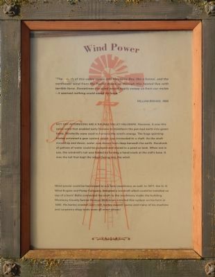
Wind Power
William Brewer, 1860
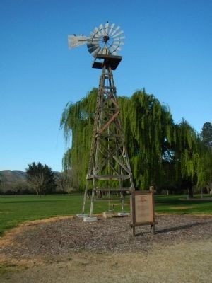
Hot, dry afternoons are a Salinas Valley hallmark. However, it was this same wind that enabled early farmers to transform the parched earth into green fields. Windmills were used to harness the wind’s energy. The huge spinning blades activated a gear system which was connected to a shaft. As the shaft moved up and down, water was drawn from deep beneath the earth. Hundreds of gallons of water could be pumped and stored in a pond or tank. When not in use, the windmill’s tail was folded by turning a hand crank at the mill’s base. It was the tail that kept the wheel facing into the wind.
Wind power could be harnessed to run farm machinery as well. In 1877, the U.S. Wind Engine and Pump Company designed a windmill which could be installed on top of a barn! Belts connected the shaft to the machinery inside the building. Monterey County farmer Duncan McKinnnan installed this system on his farm in 1890. His barley crusher, corn mill, barley cleaner, pump and many of his machine and carpentry shop tools were all wind driven!
Topics. This historical marker is listed in this topic list: Agriculture. A significant historical year for this entry is 1860.
Location. 36° 12.394′ N, 121° 8.841′ W. Marker is in King City, California, in Monterey County. Marker can be reached from San Lorenzo Park Road, on the left when traveling west. Touch for map. Marker is in this post office area: King City CA 93930, United States of America. Touch for directions.
Other nearby markers. At least 8 other markers are within 15 miles of this marker, measured as the crow flies. Salinas Valley Cookwagon, c. 1888 / Cookwagon (within shouting distance of this marker); La Gloria Schoolhouse (about 500 feet away, measured in a direct line); De Anza Expedition 1775-1776 (about 500 feet away); Mission San Antonio de Padua (approx. ¾ mile away); Metz Field/ Chapin Int'l Airport (approx. 9.1 miles away); De Anza Expedition 1775 - 1776 (approx. 14.4 miles away); First Marriage in California (approx. 14.4 miles away); The Hacienda (approx. 14.6 miles away). Touch for a list and map of all markers in King City.
More about this marker. This marker is on the grounds of the Monterey County Agricultural and Rural Life Museum in San Lorenzo Park.
Credits. This page was last revised on June 16, 2016. It was originally submitted on April 14, 2013, by Barry Swackhamer of Brentwood, California. This page has been viewed 413 times since then and 8 times this year. Photos: 1, 2. submitted on April 14, 2013, by Barry Swackhamer of Brentwood, California. • Syd Whittle was the editor who published this page.

