Spiro in Le Flore County, Oklahoma — The American South (West South Central)
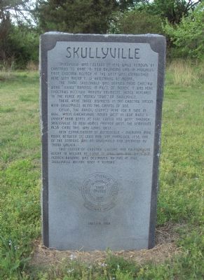
Skullyville
The name Skullyville was derived from Choctaw word “Iskuli” meaning a piece of money. It was here Choctaws received annuity payments hence referred to the place as “Money Town” or Skullyville.
There were three districts in the Choctaw Nation with Skullyville being the capitol of one.
Catlin, the artist, stopped here for a time in 1834. When Chickasaws moved west in 1838 many I landed from boats at Fort Coffee and went through Skullyville to new homes farther west. The Seminoles also came this way going west.
With establishment of Butterfield - Overland Mail Route between St. Louis and San Francisco, 1858, one of the stations was at Skullyville and operated by Tandy Walker.
This center of Choctaw culture and political life began to decline at close of Civil War and when old agency building was destroyed by fire in 1947, Skullyville became only a memory.
Erected 1968 by Oklahoma Historical Society.
Topics and series. This historical marker is listed in these topic lists: Native Americans • Settlements & Settlers. In addition, it is included in the Butterfield Overland Mail, and the Oklahoma Historical Society series lists. A significant historical year for this entry is 1832.
Location. 35° 14.992′ N, 94° 35.547′ W. Marker is in Spiro, Oklahoma, in Le Flore County. Marker is on Spring Road, 0.2 miles north of County Road 22A, on the left when traveling north. Marker is located near the entrance to Skullyville Cemetery. It is best to follow the signs from US 271. Touch for map. Marker is in this post office area: Spiro OK 74959, United States of America. Touch for directions.
Other nearby markers. At least 8 other markers are within 13 miles of this marker, measured as the crow flies. A different marker also named Skullyville (about 400 feet away, measured in a direct line); Fort Coffee (approx. 0.7 miles away); Choctaw Agency (approx. 0.7 miles away); Battle of Backbone Mountain (approx. 6.6 miles away); Reynolds Castle (approx. 7.9 miles away); Chief Mosholatubbee (approx. 12 miles away); Defending Fort Smith (approx. 13.1 miles away in Arkansas); William O. Darby (approx. 13.1 miles away in Arkansas). Touch for a list and map of all markers in Spiro.
Credits. This page was last revised on June 16, 2016. It was originally submitted on April 16, 2013, by Michael Manning of Woodlawn, Tennessee. This page has been viewed 954 times since then and 49 times this year. Photo 1. submitted on April 16, 2013, by Michael Manning of Woodlawn, Tennessee. • Bernard Fisher was the editor who published this page.
Editor’s want-list for this marker. Wide shot of marker and its surroundings. • Can you help?
