Jamestown in Chautauqua County, New York — The American Northeast (Mid-Atlantic)
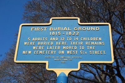
First Burial Ground
1815-1822
Photographed by Mike Wintermantel, April 21, 2013
1. First Burial Ground Marker
Erected 2003 by Jamestown Historical Marker Committee.
Topics. This historical marker is listed in this topic list: Cemeteries & Burial Sites.
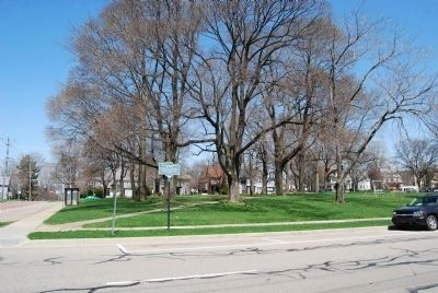
Location. 42° 5.782′ N, 79° 14.839′ W. Marker is in Jamestown, New York, in Chautauqua County. It is at the intersection of West 4th Street and Clinton Street, on the right when traveling west on West 4th Street. Located on the southwest corner of Baker Park. Touch for map. Marker is in this post office area: Jamestown NY 14701, United States of America. Touch for directions.

Regionally, this marker is in Upstate New York, specifically in Western New York, and in the Southern Tier. It is also in the American Northeast, in the Mid-Atlantic, in Appalachia, and specifically in Northern Appalachia. Globally, it is in North America, on the Great Lakes, in the Western Hemisphere, in the Western World, and in the Anglosphere. Historically, it finds itself in what was once the Haudenosaunee (Iroquois)
this page online
Other nearby markers. At least 8 other markers are within walking distance of this marker: The Jamestown Underground Railroad Tableau (within shouting distance of this marker); Baker Park (within shouting distance of this marker); First Train (approx. 0.2 miles away); The Car Barns (approx. 0.2 miles away); James Prendergast (approx. 0.2 miles away); West Third Street Bridge (approx. 0.2 miles away); Samuel A. Carlson (approx. ¼ mile away); Robert H. Jackson (approx. ¼ mile away). Touch for a list and map of all markers in Jamestown.
Photographed by Mike Wintermantel, April 21, 2013
2. First Burial Ground Marker
Photographed by Mike Wintermantel, April 21, 2013
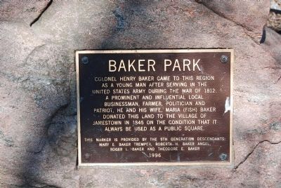
3. Baker Park marker
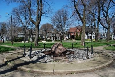
Located on a rock in the center of Baker Park: Colonel Henry Baker came to this region as a young man serving in the United States Army during the War of 1812. A prominent and influential businessman, farmer, politician and patriot, he and his wife Maria (Fish) Baker donated this land to the Village of Jamestown in 1845 on the condition that it always be used as a public square.
Photographed by Mike Wintermantel, April 21, 2013
4. Baker Park Marker
Credits. This page was last revised on June 16, 2016. It was originally submitted on April 22, 2013, by Mike Wintermantel of Pittsburgh, Pennsylvania. This page has been viewed 1,000 times since then and 49 times this year. Photos: 1, 2, 3, 4. submitted on April 22, 2013, by Mike Wintermantel of Pittsburgh, Pennsylvania.
