Near Butler in Bates County, Missouri — The American Midwest (Upper Plains)
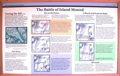
The Battle of Island Mound
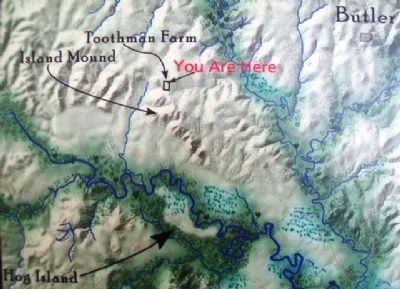
During the fall of 1862, Bates County had become a haven for guerrillas and Confederate recruiters. One of their favorite haunts was a marshy tract on the Marais-des-Cygnes River, southwest of Butler, known to locals as "Hog Island." On Oct. 27, approximately 240 members of the First Kansas Colored Volunteer Infantry marched into Bates County to clear out the rebels.
Fort Africa
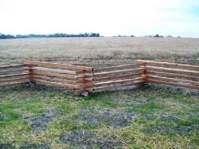
The black troops commandeered the farmstead of local Southern sympathizers, Enoch and Christiana Toothman, fortified the yard with fence rails, and christened it "Fort Africa."
Scouts and local citizens reported that a force of several hundred Southern sympathizers - bushwhackers or guerrillas - were in the area. Messengers returned to Kansas to request reinforcements. The First Kansas planned to skirmish with the Southerners until reinforcements arrived and then make a strong final attack. During the next two days, the black soldiers skirmished with the bushwhackers.
Fire on the Prairie
On Oct. 29, a detachment of about 30 black troops under Capt. Andrew Armstrong and Lt. Richard Hinton were sent to engage the bushwhackers as a diversion while a foraging party tried to replenish dwindling food supplies.
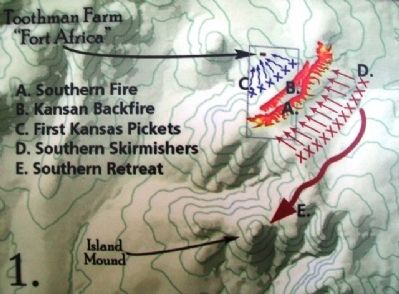
1. After the Kansas troops returned to camp, the rebels set fire to the prairie. The Kansans set a backfire to prevent the raging flames from reaching Fort Africa. Using the smoke as cover, rebel skirmishers shot at the black pickets, driving them back to Fort Africa. The rebels withdrew, hoping to provoke a pursuit by the First Kansas.
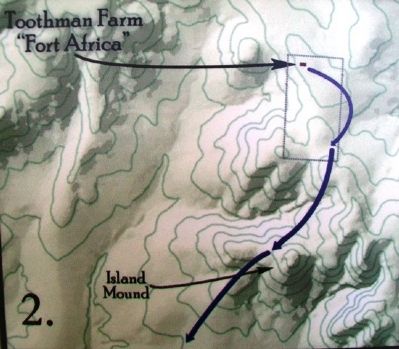
2. Capt. Henry Seaman sent out a party of eight to scout the rebel position. They were supposed to remain in view of camp. However, they ventured out of sight behind a low hill known as Island Mound.
Lt. Joseph Gardner and about 20 men left camp to find the scouting party. Instead of returning, they joined forces and proceeded into the river bottom to investigate a log house about half a mile away. Capt. Andrew Crew and Lt. Elkanah Huddleston left camp without orders and also joined the black force. The black troops had been lured farther away from their camp and into a rebel trap.
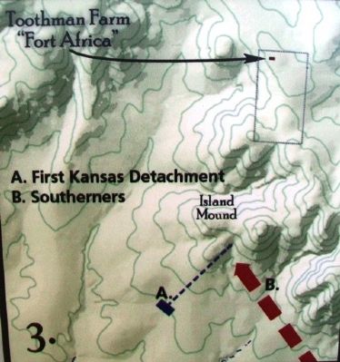
3. The small party of Kansans were about a mile from Fort Africa when some 130 rebel horsemen emerged from the woods bordering the Marais-des-Cygnes River and galloped toward the black soldiers. The black detachment retreated toward Island Mound and the shelter of a ravine. The Southern horsemen caught up to them before they could reach the ravine.
A Bloody and Desperate Battle
On the southern slope of Island Mound the two groups clashed in deadly fighting. Amidst the prairie fires set by both sides, the bloody and desperate battle was fought hand to hand with no mercy given.
There was no unit cohesion as the Southerners rode in among the trapped black soldiers. Outnumbered six to one, they faced a mounted foe armed with shotguns, pistols and sabers. The black soldiers fought back ferociously, using their bayonets and the butts of their rifles against their attackers.
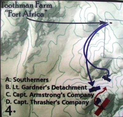
4. Many Southern horsemen rode through the Federal position and around the western side of Island Mound. They were met by Capt. Armstrong's company, which was coming to the support of Gardner's embattled detachment. As the horsemen moved around Armstrong's position to flank him, Capt. Luther Thrasher's company took a position on the northeast edge of Island Mound.
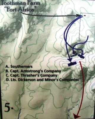
5. As the Southerners rode around the northern side of the mound, Thrasher opened fire on them. Lts. Luther Dickerson and Patrick Minor blocked a rebel breakthrough to the north. The Southerners retreated over the top of Island Mound and back to Hog Island.
Aftermath
Casualties of the First Kansas Colored Volunteer Infantry were eight killed and 11 wounded. Southern losses are not known but were probably similar. The day after the battle, Union reinforcements arrived and the combined force moved on Hog Island only to discover that it had been vacated. Newspapers across the nation
reported on the battle. Accounts about the black soldiers' bravery helped to ease doubts about how former enslaved men might perform in battle.
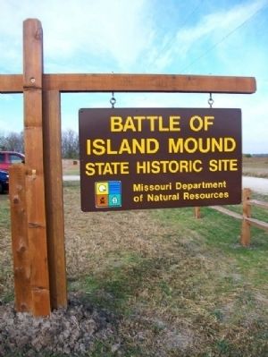
Erected by Missouri Dept of Natural Resources.
Topics. This historical marker is listed in these topic lists: African Americans • War, US Civil. A significant historical year for this entry is 1862.
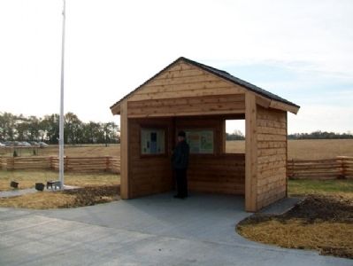
Location. 38° 14.194′ N, 94° 26.336′ W. Marker is near Butler, Missouri, in Bates County. Marker is on Marth Road (County Route 1002) near Cooper Road (County Route 5001), on the left when traveling west. Marker is in the kiosk on the grounds of Battle of Island Mound State Historic Site. Touch for map. Marker is in this post office area: Butler MO 64730, United States of America. Touch for directions.
Other nearby markers. At least 8 other markers are within 6 miles of this marker, measured as the crow flies. The Battle of Island Mound: A Demonstration to the Nation (here, next to this marker); First Kansas Colored Volunteer Infantry Regimental History (here, next to this marker); Battle of Island Mound Memorial (within shouting distance of this marker); The Toothman Farm (about 400 feet away, measured in a direct line); Bates County, Missouri in 1862 (approx. 0.2 miles away); Prairie Fire and the Battle of Island Mound (approx. 0.2 miles away); Replica of the Statue of Liberty
(approx. 5.6 miles away); Butler History Murals (approx. 5.9 miles away). Touch for a list and map of all markers in Butler.
Regarding The Battle of Island Mound. Maps adapted from Missouri State Parks file maps created by Jim Denny based off research by Chris Tabor.
Also see . . .
1. The Battle of Island Mound. (Submitted on May 4, 2013, by William Fischer, Jr. of Scranton, Pennsylvania.)
2. First Kansas Colored Infantry. (Submitted on May 4, 2013, by William Fischer, Jr. of Scranton, Pennsylvania.)
3. Battle of Island Mound State Historic Site. (Submitted on May 4, 2013, by William Fischer, Jr. of Scranton, Pennsylvania.)
Credits. This page was last revised on December 15, 2020. It was originally submitted on May 4, 2013, by William Fischer, Jr. of Scranton, Pennsylvania. This page has been viewed 874 times since then and 37 times this year. Photos: 1. submitted on May 4, 2013, by William Fischer, Jr. of Scranton, Pennsylvania. 2. submitted on October 28, 2012, by William Fischer, Jr. of Scranton, Pennsylvania. 3, 4, 5, 6, 7, 8, 9. submitted on May 4, 2013, by William Fischer, Jr. of Scranton, Pennsylvania. 10. submitted on October 27, 2012, by William Fischer, Jr. of Scranton, Pennsylvania.
