Near Topeka in Shawnee County, Kansas — The American Midwest (Upper Plains)
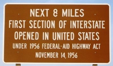
First Section of Interstate Opened in United States
Inscription.
Under 1956 Federal-Aid Highway Act
November 14, 1956
Erected by U.S. Department of Transportation.
Topics. This historical marker is listed in this topic list: Roads & Vehicles. A significant historical month for this entry is November 1858.
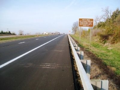
Location. 39° 3.481′ N, 95° 52.87′ W. Marker is near Topeka, Kansas, in Shawnee County. Marker is on Interstate 70 west of Valencia Road (I-70 Exit 350), on the right when traveling west. Touch for map. Marker is in this post office area: Topeka KS 66615, United States of America. Touch for directions.
Other nearby markers. At least 8 other markers are within 8 miles of this marker, measured as the crow flies. Fort Leavenworth - Fort Riley Military Road (approx. 3.4 miles away); Sioux Quartzite Boulder (approx. 5.7 miles away); Potawatomie Baptist Manual Labor Training School (approx. 5.7 miles away); Mission Kitchen Garden (approx. 5.7 miles away); Trails across Kansas (approx. 5.7 miles away); Veterans Memorial (approx. 6.7 miles away); Fool Chief's Village (approx. 7˝ miles away); Gettysburg Address (approx. 7.6 miles away). Touch for a list and map of all markers in Topeka.
More about this marker. There is an identical marker along the eastbound lanes of I-70 near mile marker 358.
Regarding First Section of Interstate Opened in United States. Historical Marker Database does not endorse stopping along the interstate to view this marker.
Credits. This page was last revised on September 16, 2020. It was originally submitted on May 4, 2013, by William Fischer, Jr. of Scranton, Pennsylvania. This page has been viewed 616 times since then and 20 times this year. Photos: 1, 2. submitted on May 4, 2013, by William Fischer, Jr. of Scranton, Pennsylvania.

