Near New Market in Shenandoah County, Virginia — The American South (Mid-Atlantic)
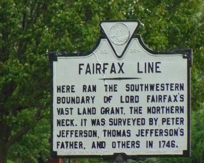
Fairfax Line
Here ran the southwestern boundary of Lord Fairfax’s vast land grant, The Northern Neck. It was surveyed by Peter Jefferson, Thomas Jefferson’s father, and others in 1746.
Erected 1927 by the Conservation & Development Commission. (Marker Number A-36.)
Topics and series. This historical marker is listed in these topic lists: Colonial Era • Political Subdivisions • Settlements & Settlers. In addition, it is included in the Virginia Department of Historic Resources (DHR) series list. A significant historical year for this entry is 1746.
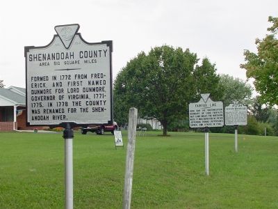
Location. This marker has been replaced by another marker nearby. It was located near 38° 38.01′ N, 78° 40.962′ W. Marker was near New Market, Virginia, in Shenandoah County. Marker was on Valley Pike (U.S. 11) south of Shady Lane, on the right when traveling south. Touch for map. Marker was in this post office area: New Market VA 22844, United States of America. Touch for directions.
Other nearby markers. At least 5 other markers are within one mile of this location, measured as the crow flies. Rockingham County / Shenandoah County (here, next to this marker); Sevier’s Birthplace (here, next to this marker); a different marker also named Fairfax Line (a few steps from this marker); Site of New Market Academy and New Market Polytechnic Institute (approx. 1.1 miles away); Replica of a 19th Century Town Pump (approx. 1.1 miles away). Touch for a list and map of all markers in New Market.
Related marker. Click here for another marker that is related to this marker. New Marker At This Location also titled "Fairfax Line".
Also see . . .
1. History of the Fairfax Line and Quest For the Fairfax Stone. by David Lee Ingram on SurveyHistory.org. (Submitted on October 27, 2006.)
2. The Fry-Jefferson Map of Virginia. Library of Virginia website entry:
The map shows the Fairfax Line and "the Indian Road," now U.S. Route 11. This marker is approximately at their intersection. (Submitted on January 27, 2024, by Larry Gertner of New York, New York.)
Credits. This page was last revised on January 27, 2024. It was originally submitted on October 27, 2006, by J. J. Prats of Powell, Ohio. This page has been viewed 1,646 times since then and 39 times this year. Photos: 1, 2. submitted on October 27, 2006, by J. J. Prats of Powell, Ohio.

