Near Sharpsburg in Washington County, Maryland — The American Northeast (Mid-Atlantic)
“It Is A.P. Hill”
"The first thing we saw was the gilt eagle that surmounted the pole, then the top of the flag, next the flutter of the stars and stripes itself, slowly mounting, up it rose, then their hats came in sight, still rising the faces emerged, next a range of curious eyes appeared, then such a hurrah as only the Yankee troops could give broke the stillness and they surged against us."
"Hastily emptying our muskets into their lines, we fled back through the cornfield. Oh, how I ran."
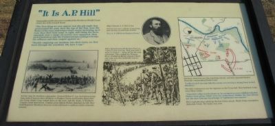
All day long the Southern commander, General Robert E. Lee, had taken troops from south of town to stave off defeat at Dunker Church and Sunken Road. Now the Union Ninth Corps looked down at the town and the Army of Northern Virginia faced destruction. Combat artist Edwin Forbes sketched the 9th New York Regiment (Hawkin's Zouaves) in their distinctive uniforms at this climatic moment.
General Lee saw a column of marching men moving up southwest of town:
"It is A.P. Hill from Harpers Ferry."
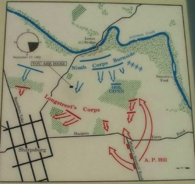
Hill's light division left Harpers Ferry at 7:30 a.m. that morning. They marched 17 miles in 8 hours - many fell by the road exhausted. They forded the Potomac River, climbed up Miller's Sawmill Road, and came onto the battlefield shortly before 4 p.m.
Northern observers saw the marching column, and they signaled General Burnside, commanding Ninth Corps:
"Look out well to your left; the enemy are moving a strong force in that direction."
The 16th Connecticut was the regiment on the Union left. They had been in the army three weeks:
"A terrible volley was fired into us. In a moment we were riddled with shot. Orders were given which were not understood. Neither the line-officers nor the men had any knowledge of regimental movements."
Hill's light division rolled up the last Union attack. Ninth Corps retreated to Antietam Creek. The battle was over.
Topics. This historical marker is listed in this topic list: War, US Civil.
Location. This marker has been replaced by another marker nearby. 39° 27.204′ N, 77° 44.351′ W. Marker is near Sharpsburg, Maryland, in Washington County. Marker is on Branch Avenue, on the left when traveling south. Located at stop 10, the Final Attack, of the driving tour of Antietam Battlefield. Touch for map. Marker is in this post office area: Sharpsburg MD 21782, United States of America. Touch for directions.
Other nearby markers. At least 8 other markers are within walking distance of this location. Brown’s (Wise), Virginia Battery (here, next to this marker); The Fate of the Army (here, next to this marker); The Advance Was Made With the Utmost Enthusiasm

Photographed By Craig Swain, February 9, 2008
2. Battle Map
Note the north seeking arrow points to the left of the map. A "you are here" pointer indicates the marker location relative to the unit movements. A battle clock on the upper left indicates the phase of the battle at which the action illustrated here took place.
More about this marker. On the left side of the marker is Edwin Forbes sketch of the 9th New York. In the center is a portrait of Major General A.P. Hill, C.S.A. above an illustration depicting the crossing of the Potomac by his division. On the right is a map illustrating the tactical movements described in the text.
Related marker. Click here for another marker that is related to this marker. New Marker At This Location titled "The Final Attack".
Also see . . . Antietam Battlefield. National Park Service site. (Submitted on March 23, 2008, by Craig Swain of Leesburg, Virginia.)

Photographed By Craig Swain, February 9, 2008
4. Federal Advance over the Ridge Lines
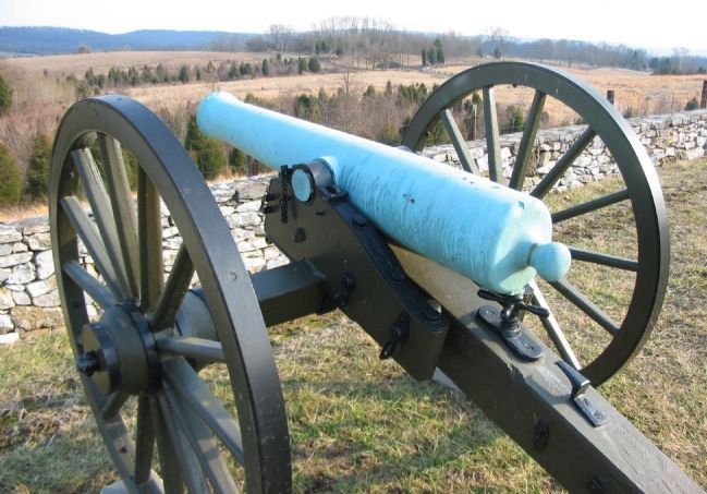
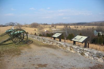
From the gunners' perspective looking down a 12-pounder Model 1857 "Napoleon" gun at the rolling ridges to the west of Antietam Creek. The Ninth Corps formed a wide arch around the bridgehead formed over the Antietam before advancing between 3:30 and 4 p.m. As described in the citation on the text, the Federals advanced up from the valley in the distance, with their colors held high, in a broad line.
Credits. This page was last revised on November 12, 2021. It was originally submitted on March 23, 2008, by Craig Swain of Leesburg, Virginia. This page has been viewed 1,388 times since then and 20 times this year. Photos: 1, 2, 3, 4. submitted on March 23, 2008, by Craig Swain of Leesburg, Virginia.

