Hagerstown in Washington County, Maryland — The American Northeast (Mid-Atlantic)
Gettysburg Campaign
Invasion & Retreat
Inscription.
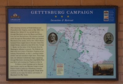
After stunning victories at Fredericksburg and Chancellorsville, Virginia, early in May 1863, Confederate Gen. Robert E. Lee carried the war through Maryland, across the Mason and Dixon Line and into Pennsylvania. His infantry marched north through the Shenandoah Valley and western Maryland as his cavalry, led by Gen. J.E.B. Stuart, harassed Union supply lines to the east. Union Gen. Joseph Hooker, replaced on June 28 by Gen. George G. Meade, led the Army of the Potomac from the Washington defenses in pursuit. The Federals collided with Lee's Army of Northern Virginia at Gettysburg, Pennsylvania, on July 1, starting a battle neither side had intended to fight there. Three days later, the defeated Confederates began retreating through Maryland, retracing their steps to the Potomac River and crossing into Virginia on July 14.
To follow in their footsteps and to discover their stories, stop by any Welcome Center or local Visitor Center to pick up a Gettysburg: Invasion & Retreat Civil War Trail map-guide. Please drive carefully as you enjoy the history and beauty of Maryland Civil War Trails.
Topics and series. This historical marker is listed in this topic list: War, US Civil. In addition, it is included in the Maryland Civil War Trails series list. A significant historical month for this entry is May 1863.
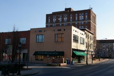
Location. 39° 38.543′ N, 77° 43.183′ W. Marker is in Hagerstown, Maryland, in Washington County. Marker is on North Potomac Street (Maryland Route 65). Touch for map. Marker is at or near this postal address: 14 North Potomac Street, Hagerstown MD 21740, United States of America. Touch for directions.
Other nearby markers. At least 8 other markers are within walking distance of this marker. Hagerstown (here, next to this marker); Treatment of the Wounded (within shouting distance of this marker); First Battle of Hagerstown (within shouting distance of this marker); Hagerstown Ransomed (within shouting distance of this marker); Second Battle of Hagerstown (within shouting distance of this marker); A City Divided (within shouting distance of this marker); Hagerstown Commercial Core Historic District (within shouting distance of this marker); Ransom of Hagerstown (about 300 feet away, measured in a direct line). Touch for a list and map of all markers in Hagerstown.
More about this marker. This is one of the standard Gettysburg Campaign markers used throughout Maryland and Virginia, and is duplicated at other locations. The maker features a map of depicting unit movements during the campaign and other Civil War Trails locations. The map has portraits of Gens. Robert E. Lee and George G. Meade. A painting depicts a scene from the campaign with the caption, “Gen. J.E.B. Stuart and his staff approach Mercerburg.”
Credits. This page was last revised on June 16, 2016. It was originally submitted on March 24, 2008, by Christopher Busta-Peck of Shaker Heights, Ohio. This page has been viewed 1,452 times since then and 13 times this year. Photos: 1, 2. submitted on March 24, 2008, by Christopher Busta-Peck of Shaker Heights, Ohio.

