Near Nazareth in Jezreel, Northern District, Israel — West Asia (the Levant in the Middle East)
Mount of Precipice
The Leaping Mountain
Photographed by Dale K. Benington, March 6, 2013
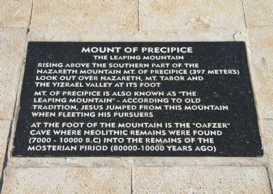
1. Mount of Precipice Marker
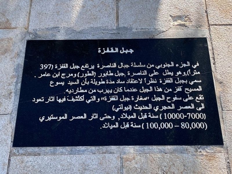
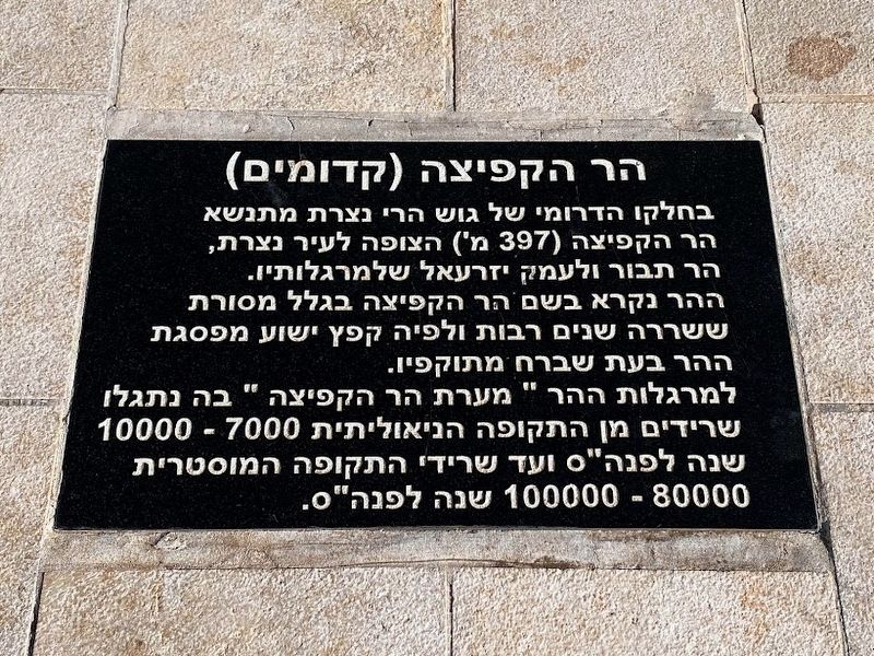
Nazareth Mountain Mt. of Precipice (397 meters)
Look out over Nazareth, Mt. Tabor and
The Yizrael Valley at its foot.
Mt. of Precipice is also known as "The
Leaping Mountain" - according to old
tradition, Jesus jumped from this mountain
when fleeting his pursuers.
At the foot of the mountain is the "Oafzer"
cave where neolithic remains were found
(7000 - 10000 B.C) into the remains of the
Mosterian Piriod (80000 - 10000 years ago)
Topics. This historical marker is listed in this topic list: Notable Events.
Location. 32° 40.841′ N, 35° 17.876′ E. Marker is near Nazareth, Northern District, in Jezreel. It can be reached from National Route 60 just south of National Route 75, on the right when traveling south. This historical marker is located south of Nazareth, on the cliffs of Mount Kedumim (397M), overlooking the Yizrael Valley and Mount Tabor. The Mount of Precipice is reached by car following the signs of "Mt Precipice" on the highway that bypasses Nazareth towards Jewish Natzeret Illit. Upon reaching the parking lot
this page online

Regionally, it is in Asia, specifically in West Asia, in the Middle East, in The Levant, on the Red Sea, in a coastal Mediterranean country, and in the Western World. Historically, it finds itself in what was once the Byzantine Empire, the Ottoman Empire, a British Mandate, and the Roman Empire.
Other nearby markers. At least 8 other markers are within 16 kilometers of this marker, measured as the crow flies: Basilica of the Annunciation (approx. 2.4 kilometers away); The Ancient Village of Nazareth (approx. 2.4 kilometers away); Byzantine Mosaics (approx. 2.4 kilometers away); Architectural Elements of the Church-Synagogue (approx. 2.4 kilometers away); The Church of St. Joseph (approx. 2.5 kilometers away); The Citadel (approx. 8.2 kilometers away); The Theater (approx. 8.3 kilometers away); Tel Megiddo National Park (approx. 14.9 kilometers away in Haifa District). Touch for a list and map of all markers in Nazareth.
Also see . . .
1. Mount Precipice.
Photographed by Dale K. Benington, March 6, 2013
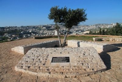
2. Mount of Precipice Marker
View of the historical marker on the summit of the Mount of Precipice, with a view of the modern day city of Nazareth seen in the distant background.
2. Mount Precipice. This is a link to information provided by BibleWalks.com. (Submitted on May 18, 2013, by Dale K. Benington of Toledo, Ohio.)
Photographed by Dale K. Benington, March 6, 2013
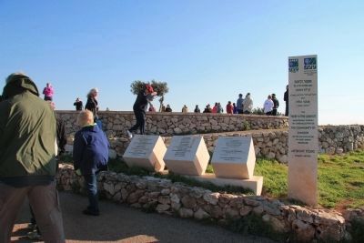
3. Mount of Precipice
View of visitors walking up the trail to the location of the historical marker. The signs along the way indicate that the park is referred to as the "Three Faiths Lookout."
Photographed by Dale K. Benington, March 6, 2013
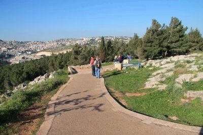
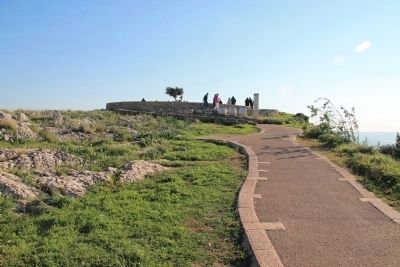
4. Mount of Precipice
View looking down the walking path, from the summit of the Mount of Precipice, with a distant view of the modern day city of nazareth in the background.
Photographed by Dale K. Benington, March 6, 2013
5. Mount of Precipice
View looking up the walking path, towards the summit of the Mount of Precipice, where the historical marker is located.
Photographed by Dale K. Benington, March 7, 2013
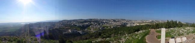
6. Mount of Precipice
A panoramic view, looking northwest from the site of the historical marker, atop the Mount of Precipice, of the walking path up to the summit and a view of the modern day city of Nazareth, on the hill to the north and west of the Mount of Precipice (click on the picture to enlarge the view).

Photographed by Dale K. Benington, March 7, 2013
7. Mount of Precipice
A panoramic view, looking east from the site of the historical marker, atop the Mount of Precipice, showing to the distant center of the picture what I believe is Mount Tabor (click on the picture to enlarge the view).
Photographed by Darren Jefferson Clay, March 7, 2023
8. Mount of Precipice Marker (Arabic)
Photographed by Darren Jefferson Clay, March 7, 2023
9. Mount of Precipice Marker (Hebrew)
Credits. This page was last revised on August 26, 2023. It was originally submitted on May 18, 2013, by Dale K. Benington of Toledo, Ohio. This page has been viewed 1,688 times since then and 53 times this year. Photos: 1, 2, 3, 4, 5, 6, 7. submitted on May 18, 2013, by Dale K. Benington of Toledo, Ohio. 8, 9. submitted on April 28, 2023, by Darren Jefferson Clay of Duluth, Georgia.
