
Canfield in Mahoning County, Ohio — The American Midwest (Great Lakes)
Zion Lutheran and Reformed Churchyard
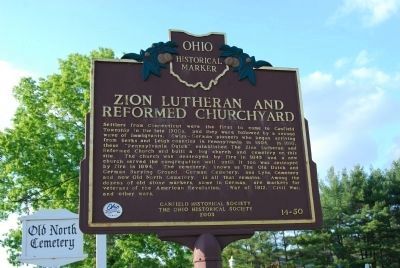
Photographed by Jenn Wintermantel, May 19, 2013
1. Zion Lutheran and Reformed Churchyard Marker
Erected 2003 by Canfield Historical Society and The Ohio Historical Society. (Marker Number 14-50.)
Topics and series. This historical marker is listed in these topic lists: Cemeteries & Burial Sites • Religion & Religious Structures. In addition, it is included in the Ohio Historical Society / The Ohio History Connection
this page online
Location. 41° 2.379′ N, 80° 45.63′ W. Marker is in Canfield, Ohio, in Mahoning County. It is on North Broad Street (U.S. 62) 0.1 miles south of Sawmill Run Drive, on the right when traveling north. Located at Old North Cemetery. Touch for map. Marker is in this post office area: Canfield OH 44406, United States of America. Touch for directions.

Regionally, this marker is in Ohio’s Western Reserve and in the Mahoning Valley. It is also in the American Midwest. Globally, it is in North America, the Western Hemisphere, the Western World, and the Anglosphere. Historically, it finds itself in what was once the Haudenosaunee (Iroquois) Confederacy, the territory of the Mississippian Culture, and the Northwest Territory.
Other nearby markers. At least 8 other markers are within 2 miles of this marker, measured as the crow flies: Elisha Whittlesey (approx. 0.9 miles away); Canfield War Vet Museum (approx. one mile away); Canfield Township Hall (approx. 1.1 miles away); Canfield Green (approx. 1.1 miles away); The Mahoning Dispatch Building (approx. 1.1 miles away);
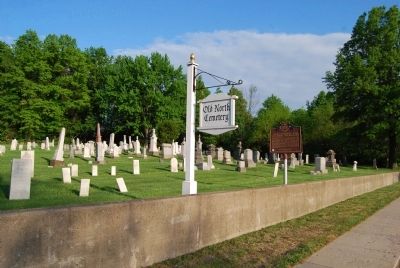
Photographed by Jenn Wintermantel, May 19, 2013
2. Zion Lutheran and Reformed Churchyard Marker
Credits. This page was last revised on June 16, 2016. It was originally submitted on May 19, 2013, by Mike Wintermantel of Pittsburgh, Pennsylvania. This page has been viewed 872 times since then and 20 times this year. Photos: 1, 2. submitted on May 19, 2013, by Mike Wintermantel of Pittsburgh, Pennsylvania.
