Bath in Beaufort County, North Carolina — The American South (South Atlantic)
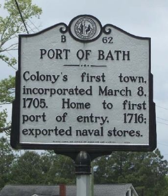
Port Of Bath
Photographed by Mike Stroud, April 19, 2013
1. Port Of Bath Marker
Erected 2004 by North Carolina Office of Archives and History. (Marker Number B-62.)
Topics and series. This historical marker is listed in these topic lists: Colonial Era • Settlements & Settlers. In addition, it is included in the North Carolina Division of Archives and History series list. A significant historical date for this entry is March 8, 1758.
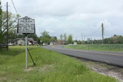
Location. 35° 28.618′ N, 76° 49.398′ W. Marker is in Bath, North Carolina, in Beaufort County. It is on State Highway 92 / 99 just west of Brookshire, on the right when traveling east. located west of the Pamlico River bridge. Touch for map. Marker is in this post office area: Bath NC 27808, United States of America. Touch for directions.

Regionally, this marker is in the Coastal Plain. It is also in the American South, specifically in the Upper South, in the Tidewater, and on the Eastern Seaboard. Globally, it is in the North Atlantic Region, North America, the Western Hemisphere, the Western World, and the Anglosphere. Historically, it finds itself in what
this page online
Other nearby markers. At least 8 other markers are within walking distance of this marker: Port of Bath and Thomas Harding (approx. half a mile away); James Adams Floating Theatre (approx. half a mile away); Matthew Rowan (approx. half a mile away); Colonial Bath (approx. half a mile away); Palmer-Marsh House (approx. half a mile away); First Public Library (approx. half a mile away); First Post Road (approx. half a mile away); John F. Tompkins (approx. 0.6 miles away). Touch for a list and map of all markers in Bath.
Regarding Port Of Bath. Bath, incorporated in 1705, is North Carolina’s oldest town. In the eighteenth century, Bath was a thriving town of vital importance to the fledgling colony. It became the colony’s first port in 1716 when it was deemed “the most proper place within the said Province for ships to take in masts, pitch, Tar, Turpentine, and other Naval Stores for the use of his Majesty’s Fleet.” Port Bath remained an important center of export throughout
Photographed by Mike Stroud, April 19, 2013
2. Port Of Bath Marker along North Carolina Route 92 / 99, here looking west
Among the earliest residents of Bath were John Lawson, Christopher Gale, Maurice Luellyn, Capt. James Beard, and Nathaniel Wyarsdale. The first town lots, recorded and acknowledged in court on October 1, 1706, were those belonging to Christopher Gale, the first Chief Justice of the colony. The following year Bath added a gristmill and the colony’s first shipyard. Other North Carolina firsts in Bath include the public library, St. Thomas Church, and the post road. The General Assembly met in Bath in 1743, 1744, and 1752. In 1746 the town was considered for capital of the colony. Bath was home to colonial governors Robert Daniel, Thomas Cary, Charles Eden, and Matthew Rowan. When the Beaufort County seat was moved to Washington, twelve miles away, Bath lost much of its trade and status, becoming the quiet, rural town that it is today. (North Carolina Office of Archives & History — Department of Cultural Resources)
Credits. This page was last revised on June 22, 2021. It was originally submitted on May 25, 2013, by Mike Stroud of Bluffton, South Carolina. This page has been viewed 970 times since then and 57 times this year. Photos: 1, 2. submitted on May 27, 2013, by Mike Stroud of Bluffton, South Carolina.
