
Renovo in Clinton County, Pennsylvania — The American Northeast (Mid-Atlantic)
Simeon & Susannah Pfoutz
1781-1856 1794-1848
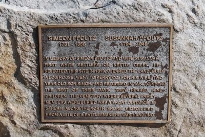
Photographed by Mike Wintermantel, May 27, 2013
1. Simeon & Susannah Pfoutz Marker
Topics. This historical marker is listed in these topic lists: Settlements & Settlers • Waterways & Vessels. A significant historical year for this entry is 1813.
Location. 41° 21.567′ N, 77° 55.688′ W. Marker is in Renovo, Pennsylvania, in Clinton County. It can be reached from Kettle Creek Road (Pennsylvania Route 4001) 1.1 miles south of Sugar Camp Road. Located in the parking lot of Alvin R. Bush (Kettle Creek) Dam. Touch for map. Marker is in this post office area: Renovo PA 17764, United States of America. Touch for directions.

Regionally, this marker is in the Pennsylvania Wilds and in the Susquehanna Valley. It is also in the American Northeast, in the Mid-Atlantic,
this page online
Other nearby markers. At least 2 other markers are within 11 miles of this marker, measured as the crow flies: Leidy Natural Gas Boom (approx. 3.1 miles away); Pepper Hill Fire of 1938 (approx. 7.2 miles away).
Another marker is no longer nearby. Sinnemahoning Path (was approx. 10.2 miles away but has been confirmed missing).
Also see . . . Kettle Creek State Park. (Submitted on May 28, 2013, by Mike Wintermantel of Pittsburgh, Pennsylvania.)
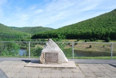
Photographed by Mike Wintermantel, May 27, 2013
2. Simeon & Susannah Pfoutz Marker
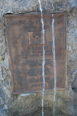
Photographed by Mike Wintermantel, May 27, 2013
3. Alvin R. Bush Dam plaque
Alvin R. Bush Dam
Kettle Creek
U.S. Army Corps of Engineers
Baltimore District
Kettle Creek
U.S. Army Corps of Engineers
Baltimore District
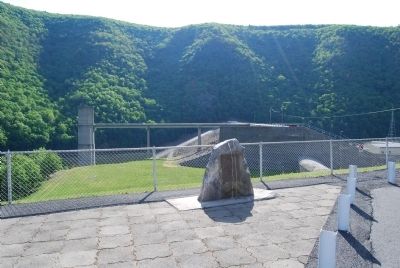
Photographed by Mike Wintermantel, May 27, 2013
4. Alvin R. Bush Dam plaque
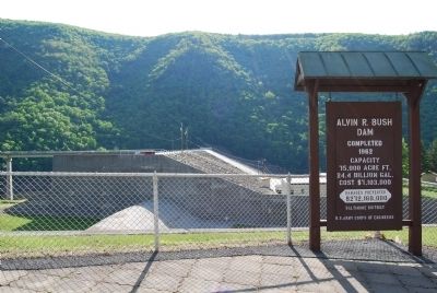
Photographed by Mike Wintermantel, May 27, 2013
5. Alvin R. Bush Dam
Credits. This page was last revised on March 13, 2020. It was originally submitted on May 28, 2013, by Mike Wintermantel of Pittsburgh, Pennsylvania. This page has been viewed 1,069 times since then and 31 times this year. Photos: 1, 2, 3, 4, 5. submitted on May 28, 2013, by Mike Wintermantel of Pittsburgh, Pennsylvania.
