Near Fort Oglethorpe in Walker County, Georgia — The American South (South Atlantic)
Brannan's Division
Thomas' Corps.
| — | Brig. Gen. John M. Brannan | — |
Photographed by Dale K. Benington, July 18, 2012
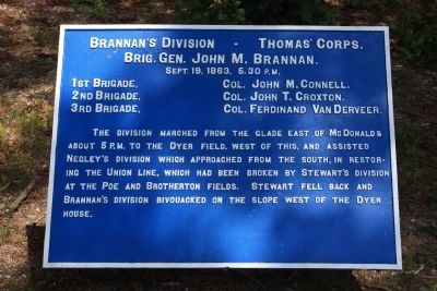
1. Brannan's Division Marker
Brig. Gen. John M. Brannan.
Sept. 19, 1863, 5:30 P.M.
1st Brigade, - Col. John M. Connell.
2nd Brigade, - Col. John T. Croxton.
3rd Brigade, - Col. Ferdinand VanDerveer.
The division marched from the glade east of McDonalds about 5 P.M. to the Dyer field, west of this, and assisted Negley's division which approached from the south, in restoring the Union line, which had been broken by Stewart's division at the Poe and Brotherton fields. Stewart fell back and Brannan's division bivouacked on the slope west of the Dyer house.
Erected 1890 by the Chickamauga and Chattanooga National Military Park Commission. (Marker Number MT-496.)
Topics. This historical marker is listed in this topic list: War, US Civil. A significant historical date for this entry is September 19, 1944.
Location. 34° 55.295′ N, 85° 15.866′ W. Marker is near Fort Oglethorpe, Georgia, in Walker County. It is on Glenn-Kelly Road north of Dyer Road, on the right when traveling north. This historical marker is located in the national park that preserves the site of the Chickamauga Battlefield, along the east side of the Glenn-Kelly
this page online

Regionally, this marker is in Georgia’s Mountains. It is also in the American South, specifically in the Deep South, in Appalachia, and specifically in Southern Appalachia. Globally, it is in North America, the Western Hemisphere, the Western World, and the Anglosphere. Historically, it finds itself in what was once the original Cherokee Nation, the territory of the Mississippian Culture, one of the original Thirteen Colonies, one of the Confederate States of America, and the Antebellum South.
Other nearby markers. At least 8 other markers are within walking distance of this marker: Van Derveer's Brigade (within shouting distance of this marker); Kershaw's Brigade (about 300 feet away, measured in a direct line); 15th Georgia Infantry (about 400 feet away); S. Beatty's Brigade (about 400 feet away); Croxton's Brigade. (about 500 feet away); To Capture of Nine Union Guns (about 500 feet away); 64th Ohio Infantry (about 500 feet away); 20th Georgia Infantry (about 600 feet away). Touch for a list and map
Photographed by Dale K. Benington, July 18, 2012
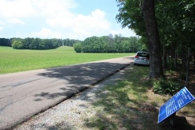
2. Brannan's Division Marker
View of the historical marker looking north along the Glenn - Kelly Road, with a view of Snodgrass Hill off in the far distant left background of the picture.
More about this marker. I used the "Chickamauga Battlefield" map, that I purchased at the Chickamauga and Chattanooga National Military Park, Visitor Center, to determine both the monument number for this marker and the marker's location in relation to the rest of the park's monuments, markers, and tablets. According to the map it provides the, "numerical listing of all monuments, markers, and tablets on the Chickamauga Battlefield (using the Chick-Chatt NMP Monument Numbering System).”
Photographed by Dale K. Benington, July 17, 2012
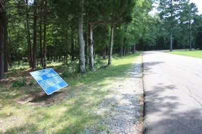
3. Brannan's Division Marker
View of the historical marker looking south along the Glenn - Kelly Road.
Internet Archive
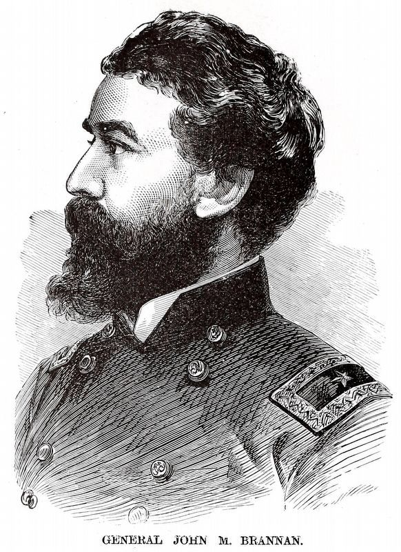
4. General John M. Brannan
From Frank Leslie's Scenes and Portraits of the Civil War... by Frank Leslie, 1894, Page 246.
Credits. This page was last revised on March 23, 2024. It was originally submitted on May 29, 2013, by Dale K. Benington of Toledo, Ohio. This page has been viewed 490 times since then and 14 times this year. Photos: 1, 2, 3. submitted on May 29, 2013, by Dale K. Benington of Toledo, Ohio. 4. submitted on March 23, 2024, by Allen C. Browne of Silver Spring, Maryland.
