College Township near State College in Centre County, Pennsylvania — The American Northeast (Mid-Atlantic)
John I. Thompson Grain Elevator and Coal Sheds
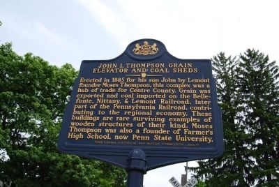
Photographed by Mike Wintermantel, May 27, 2013
1. John I. Thompson Grain Elevator and Coal Sheds Marker
Erected 2006 by Pennsylvania Historical and Museum Commission.
Topics and series. This historical marker is listed in these topic lists: Agriculture • Education • Industry & Commerce • Railroads & Streetcars. In addition, it is included in the Pennsylvania Historical and Museum Commission (PHMC), and the Pennsylvania State University series lists. A significant historical year for this entry is 1885.
Location. 40° 48.618′ N, 77° 49.038′ W. Marker is near State College, Pennsylvania, in Centre County. It is in College Township. It is at the intersection of Mt. Nittany Road and Mulberry Lane, on the right when traveling east on Mt. Nittany Road. Touch for map.
this page online

Regionally, this marker is in the Pennsylvania Wilds. It is also in the American Northeast, in the Mid-Atlantic, in Appalachia, and specifically in Northern Appalachia. Globally, it is in North America, the Western Hemisphere, the Western World, and the Anglosphere. Historically, it finds itself in what was once the Haudenosaunee (Iroquois) Confederacy and also one of the original Thirteen Colonies.
Other nearby markers. At least 8 other markers are within 2 miles of this marker, measured as the crow flies: Centre Furnace Mansion (approx. 1.3 miles away); Tree and Shrub Border (approx. 1.3 miles away); American Sycamore (approx. 1.3 miles away); Centre Furnace Forges a Community (approx. 1.3 miles away); Moses Thompson (approx. 1.4 miles away); The Gardeners Garden (approx. 1.4 miles away); Centre Furnace (approx. 1.4 miles away); Path of a Historic Waterway (approx. 1.4 miles away). Touch for a list and map of all markers in State College.
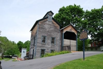
Photographed by Mike Wintermantel, May 27, 2013
2. John I. Thompson Grain Elevator and Coal Sheds Marker
Credits. This page was last revised on February 7, 2023. It was originally submitted on May 29, 2013, by Mike Wintermantel of Pittsburgh, Pennsylvania. This page has been viewed 932 times since then and 33 times this year. Photos: 1, 2. submitted on May 29, 2013, by Mike Wintermantel of Pittsburgh, Pennsylvania.
