Liberal in Seward County, Kansas — The American Midwest (Upper Plains)
Original Hand-Dug Well
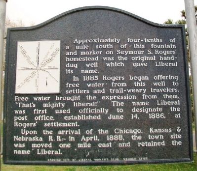
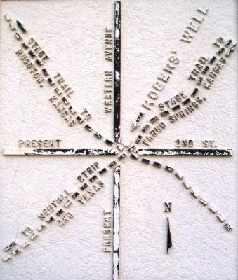
Approximately four-tenths of a mile south of this fountain and marker on Seymour S. Rogers' homestead was the original hand-dug well which gave Liberal its name.
In 1885 Rogers began offering free water from this well to settlers and trail-weary travelers. Free water brought the expression from them, "That's mighty liberal!" The name Liberal was first used officially to designate the post office, established June 14, 1886, at Rogers' settlement.
Upon the arrival of the Chicago, Kansas & Nebraska R.R. in April, 1888, the town site was moved one mile east and retained the name Liberal.
Erected 1974 by Liberal Woman's Club, Member GFWC.
Topics. This historical marker is listed in these topic lists: Charity & Public Work • Roads & Vehicles • Settlements & Settlers. A significant historical month for this entry is April 1888.
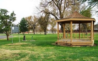
Location. 37° 2.766′ N, 100° 56.4′ W. Marker is in Liberal, Kansas, in Seward County. Marker is on Western Drive north of 7th Street, on the right when traveling north. Marker is in Blue Bonnet Park. Touch for map. Marker is in this post office area: Liberal KS 67901, United States of America. Touch for directions.
Other nearby markers. At least 8 other markers are within 2 miles of this marker, measured as the crow flies. Liberal Army Air Base Memorial (approx. 0.7 miles away); International Pancake Day (approx. one mile away); The Pioneer Mother of Kansas (approx. one mile away); Replica of the Statue of Liberty (approx. one mile away); Liberal Memorial Library (approx. one mile away); War Memorial (approx. 1.1 miles away); Seward County War Dead and Missing in Action (approx. 1.1 miles away); Rock Island Lines (approx. 1.2 miles away). Touch for a list and map of all markers in Liberal.
Credits. This page was last revised on September 8, 2020. It was originally submitted on June 4, 2013, by William Fischer, Jr. of Scranton, Pennsylvania. This page has been viewed 745 times since then and 39 times this year. Photos: 1, 2, 3. submitted on June 4, 2013, by William Fischer, Jr. of Scranton, Pennsylvania.


