Near Galesville in Anne Arundel County, Maryland — The American Northeast (Mid-Atlantic)
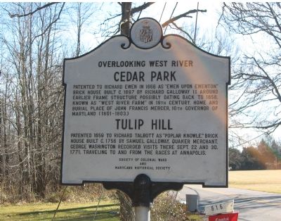
Overlooking West River
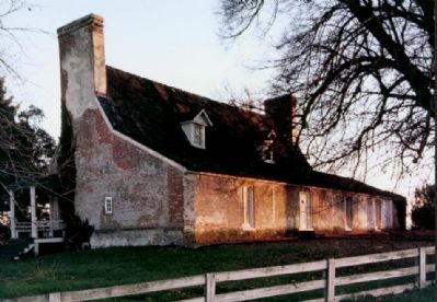
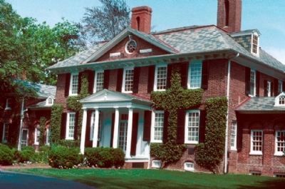
Cedar Park, Tulip Hill
Erected by Society of Colonial Wars and Maryland Historical Society.
Topics and series. This historical marker is listed in these topic lists: Colonial Era • Settlements & Settlers. In addition, it is included in the Former U.S. Presidents: #01 George Washington, the George Washington Slept Here, the National Historic Landmarks, and the Quakerism series lists. A significant historical date for this entry is September 22, 1672.
Location. 38° 50.988′ N, 76° 33.43′ W. Marker is near Galesville, Maryland, in Anne Arundel County. Marker is on Muddy Creek Road, 0.1 miles east of Galesville Road, on the right when traveling east. Touch for map. Marker is in this post office area: West River MD 20778, United States of America. Touch for directions.
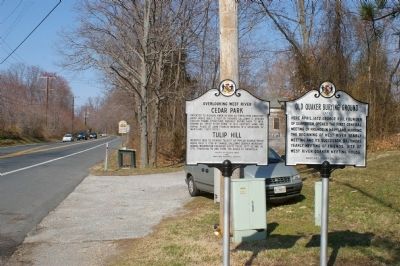
Other nearby markers. At least 8 other markers are within walking distance of this marker. Old Quaker Burying Ground (here, next to this marker); Site of First Quaker Regional Gathering (within shouting distance of this marker); Veterans Memorial (approx. ¾ mile away); William Penn (approx. 0.8 miles away); Carrie Weedon House (approx. 0.9 miles away); Welcome to Galesville (approx. 0.9 miles away); Native Plants (approx. 0.9 miles away); Where Land Meets Water (approx. 0.9 miles away). Touch for a list and map of all markers in Galesville.
Also see . . . Tulip Hill, Colonial gem in Anne Arundel, is on the auction block. 2010 article by Amy Reinink in The Washington Post. “The house has retained almost all of its original features, from the paneling and pine floors downstairs to the marble-faced fireplaces throughout. ‘This house is as original as it comes,’ [Gary] Gestson [of Long & Foster Realty] said. The house also boasts a stone basement and an attic that leads to a widow’s walk overlooking the West River and what [Donna] Ware [an architectural historian] described as ‘perhaps the most impressive terraced gardens in the United States’.” (Submitted on March 27, 2010, by J. J. Prats of Powell, Ohio.)
Credits. This page was last revised on January 30, 2024. It was originally submitted on October 18, 2007, by F. Robby of Baltimore, Maryland. This page has been viewed 3,181 times since then and 84 times this year. Last updated on June 12, 2013, by Allen C. Browne of Silver Spring, Maryland. Photos: 1. submitted on October 18, 2007, by F. Robby of Baltimore, Maryland. 2. submitted on March 13, 2008, by Christopher Busta-Peck of Shaker Heights, Ohio. 3, 4. submitted on March 22, 2008, by Christopher Busta-Peck of Shaker Heights, Ohio. 5. submitted on January 30, 2024, by Allen C. Browne of Silver Spring, Maryland. • Bill Pfingsten was the editor who published this page.
