Calpine in Sierra County, California — The American West (Pacific Coastal)
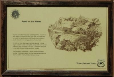
Food for the Mines
49 Miles Along Highway 49
In 1870, the Yuba Gap wagon road was opened. The first wagon over the summit belonged to Joseph Miller and carried butter and eggs. Originally a toll road, a horse and ride paid $1.50, cattle .50 each, sheep and hogs .25 each.
This high Sierra country was a perfect location for sheep herding. The Basque people from the Pyrennes Mountain of Spain used this area for herding flocks of sheep.
Erected by Tahoe National Forest.
Topics. This historical marker is listed in these topic lists: Roads & Vehicles • Settlements & Settlers. A significant historical year for this entry is 1852.
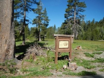
Location. This marker has been replaced by another marker nearby. It was located near 39° 36.996′ N, 120° 29.404′ W. Marker was in Calpine, California, in Sierra County. Marker was at the intersection of Golden Chain Highway (California Route 49) and Yuba Pass Road, on the right when traveling east on Golden Chain Highway. Touch for map. Marker was in this post office area: Calpine CA 96124, United States of America. Touch for directions.
Other nearby markers. At least 8 other markers are within 10 miles of this location, measured as the crow flies. Crossing the Summit - Weather or Not (here, next to this marker); Site of Howard Ranch and Inn 1865 (approx. 5.4 miles away); Memorial (approx. 7.6 miles away); Busch & Heringlake Building (approx. 8.4 miles away); Miner’s Hotel (approx. 8.6 miles away); Webber Lake Hotel (approx. 9.7 miles away); Henness – Zumwalt Pass (approx. 9.7 miles away); Here Today – Gone Tomorrow (approx. 9.8 miles away).
Credits. This page was last revised on November 20, 2016. It was originally submitted on June 15, 2013, by Barry Swackhamer of Brentwood, California. This page has been viewed 445 times since then and 4 times this year. Photos: 1, 2. submitted on June 15, 2013, by Barry Swackhamer of Brentwood, California. • Syd Whittle was the editor who published this page.

