Red House in Charlotte County, Virginia — The American South (Mid-Atlantic)
Red House
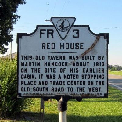
Photographed by Bernard Fisher, June 15, 2013
1. Red House Marker
Erected 1929 by Conservation & Development Commission. (Marker Number FR-3.)
Topics and series. This historical marker is listed in these topic lists: Industry & Commerce • Roads & Vehicles. In addition, it is included in the Virginia Department of Historic Resources (DHR) series list. A significant historical year for this entry is 1813.
Location. 37° 11.359′ N, 78° 48.712′ W. Marker is in Red House, Virginia, in Charlotte County. It is at the intersection of Red House Road (Virginia Route 727) and Lawyers Road, on the right when traveling south on Red House Road. Touch for map. Marker is in this post office area: Red House VA 23963, United States of America. Touch for directions.

Regionally, this marker is in the Piedmont, in Southside Virginia, and specifically in Central Virginia. It is also in the American South and specifically in the Upper South. Globally, it is in North America, the Western Hemisphere, the Western World, and
this page online
Other nearby markers. At least 8 other markers are within 11 miles of this marker, measured as the crow flies: Charlotte County / Appomattox County (approx. 0.9 miles away); Rough Creek Church (approx. 5.6 miles away); Campbell County / Charlotte County (approx. 8.6 miles away); Appomattox County / Prince Edward County (approx. 8.9 miles away); Patrick Henry’s Grave (approx. 9 miles away); Clay Smoking Pipes (approx. 9.1 miles away); Hat Creek Church (approx. 9.6 miles away); a different marker also named Cub Creek Church (approx. 10½ miles away).
Another marker is no longer nearby. Cub Creek Church (was approx. 10½ miles away but has been replaced with another marker now near it).
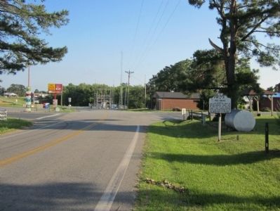
Photographed by Bernard Fisher, June 15, 2013
2. Red House Rd & Lawyers Rd
Credits. This page was last revised on August 6, 2020. It was originally submitted on June 16, 2013, by Bernard Fisher of Richmond, Virginia. This page has been viewed 2,350 times since then and 196 times this year. Photos: 1, 2. submitted on June 16, 2013, by Bernard Fisher of Richmond, Virginia.
