Haddam in Middlesex County, Connecticut — The American Northeast (New England)
Haddam
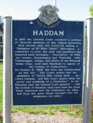
On October 8, 1668, the town was incorporated by this Act: “The Court orders that the plantation of Thirty Mile Island shall be called Haddum, and this Court grants them the power and Priuiledg of a Plantation.” In the following year the General Court granted “ that the bownds of Haddum shall runn from the great Riuer westward into the wilderness six miles, and from the great Riuer eastward into the wilderness six miles.
( back )
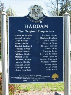
The Original Proprietors
The American Revolution Bicentennial Committee of Haddam
and the Connecticut Historical Commission
May 30, 1976
Erected 1976 by the Town of Haddam, The American Revolution Bicentennial Committee of Haddam, the Connecticut Historical Commission.
Topics. This historical marker is listed in these topic lists: Colonial Era • Settlements & Settlers. A significant historical month for this entry is May 2004.
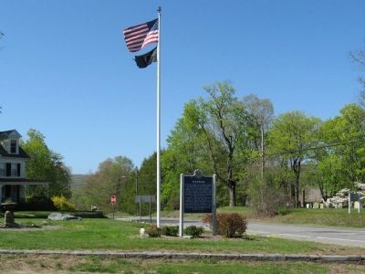
Location. 41° 28.841′ N, 72° 30.98′ W. Marker is in Haddam, Connecticut, in Middlesex County. Marker is at the intersection of Saybrook Road (Connecticut Route 154) and Walkley Hill Road, on the left when traveling north on Saybrook Road. Touch for map. Marker is in this post office area: Haddam CT 06438, United States of America. Touch for directions.
Other nearby markers. At least 8 other markers are within 4 miles of this marker, measured as the crow flies. Site Of Haddam Town Hall (a few steps from this marker); Thirty Mile Island Plantation Burying Ground (a few steps from this marker); Haddam Veterans Monument (approx. 2½ miles away); Goodspeed Opera House (approx. 3.4 miles away); East Haddam (approx. 3.4 miles away); East Haddam Veterans Memorial (approx. 3.7 miles away); East Haddam Persian Gulf War Monument (approx. 3.7 miles away); Soldiers' Memorial (approx. 3.7 miles away). Touch for a list and map of all markers in Haddam.
Regarding Haddam. In 1660 the Connecticut Colonial Legislature sent Matthew Allyn and Samuel Willys down the Connecticut River from Hartford to purchase land from the Wangunk Indian Tribe at the place the English called 'Land of Thirty Mile Island'. The island, now known as Haddam Island was thought to be thirty miles from the mouth of the "Grate River" at Long Island Sound (it is only 17 miles from the mouth of river). In May 1662 the Englishmen finally purchased land comprising approximately 104 square miles and extending in six miles on each side of the river from the straits at "Pattyquonck" (now Chester) to the Mattabeseck-Mill River (now Middletown) across to the line of Chatham (now East Hampton). The English paid 30 coats (worth approximately $100) for the land from four Native American chiefs, two queens and others. The Native Americans did set aside some property for their own use including 40 acres at Cove Meadow (Chester) and Haddam Island as well reserving the right to hunt and fish where they pleased.
Also see . . .
1. Town of Haddam, Connecticut. (Submitted on June 20, 2013, by Michael Herrick of Southbury, Connecticut.)
2. Haddam, Connecticut on Wikipedia. (Submitted on June 20, 2013, by Michael Herrick of Southbury, Connecticut.)
3. Haddam Historical Society. (Submitted on June 20, 2013, by Michael Herrick of Southbury, Connecticut.)
Credits. This page was last revised on June 16, 2016. It was originally submitted on June 20, 2013, by Michael Herrick of Southbury, Connecticut. This page has been viewed 742 times since then and 38 times this year. Photos: 1, 2, 3. submitted on June 20, 2013, by Michael Herrick of Southbury, Connecticut.


