
Spotsylvania Courthouse in Spotsylvania County, Virginia — The American South (Mid-Atlantic)
Upton’s Trail
The Battle of Spotsylvania Court House
| — | Fredericksburg and Spotsylvania National Military Park | — |
Photographed by Bernard Fisher, June 23, 2013
1. Upton’s Trail Marker
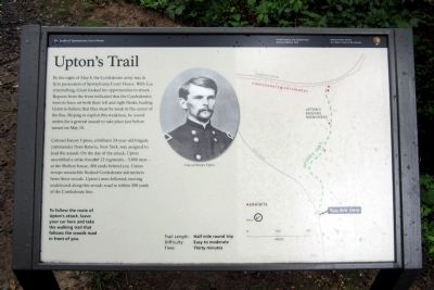
By the night of May 8, the Confederate army was in firm possession of Spotsylvania Court House. With Lee entrenching, Grant looked for opportunities to attack. Reports from the front indicated that the Confederates were in force on both their left and right flanks, leading Grant to believe that they must be weak in the center of the line. Hoping to exploit this weakness, he issued orders for a general assault to take place just before sunset on May 10.
Colonel Emory Upton, a brilliant 24-year-old brigade commander from Batavia, New York, was assigned to lead the assault. On the day of the attack, Upton assembled a strike force of 12 regiments—5,000 men—at the Shelton house, 400 yards behind you. Union troops meanwhile flushed Confederate skirmishers from these woods. Upton’s men followed, moving undetected along this woods road to within 200 yards of the Confederate line.
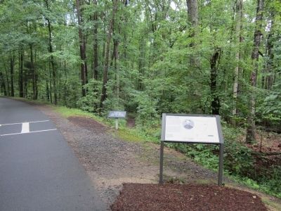
To follow the route of Upton’s attack, leave your car here and take the walking trail that follows the woods road in front of you.
Trail Length: Half mile round trip
Difficulty: Easy to moderate
Time: Thirty minutes
(caption)
Colonel Emory
this page online
Erected by National Park Service, U.S. Department of the Interior.
Topics. This historical marker is listed in this topic list: War, US Civil. A significant historical date for this entry is May 8, 1920.
Location. 38° 13.418′ N, 77° 36.377′ W. Marker is in Spotsylvania Courthouse, Virginia, in Spotsylvania County. It is on Grant Drive 0.7 miles north of Brock Road, on the right when traveling north. Touch for map. Marker is in this post office area: Spotsylvania VA 22553, United States of America. Touch for directions.

Regionally, this marker is in the Washington Metropolitan Area, in Northern Virginia, and in the Piedmont. It is also in the American South, specifically in the Upper South, in the Mid-Atlantic, and on the Eastern Seaboard. Globally, it is in the North Atlantic Region, North America, the Western Hemisphere, the Western World, and the Anglosphere. Historically, it finds itself in what was once the territory of the Mississippian Culture, one of the original Thirteen Colonies, one of the Confederate States of America, and the Antebellum South.
Other nearby markers. At least 8 other markers are within
Photographed by Bernard Fisher, June 23, 2013
2. Upton’s Trail Marker
Other markers no longer nearby. Spotsylvania Campaign (was a few steps from this marker but has been replaced with another marker now near it); a different marker also named Spotsylvania Campaign (was a few steps from this marker but has been permanently removed); Doles Salient (was approx. 0.2 miles away but has been permanently removed); a different marker also named Spotsylvania Campaign (was approx. ¼ mile away but has been permanently removed); a different marker also named Spotsylvania Campaign (was approx. ¼ mile away but has been permanently removed).
Also see . . . Fredericksburg & Spotsylvania National Military Park. National
Photographed by Bradley Owen, October 18, 2018
3. Upton’s Trail Marker
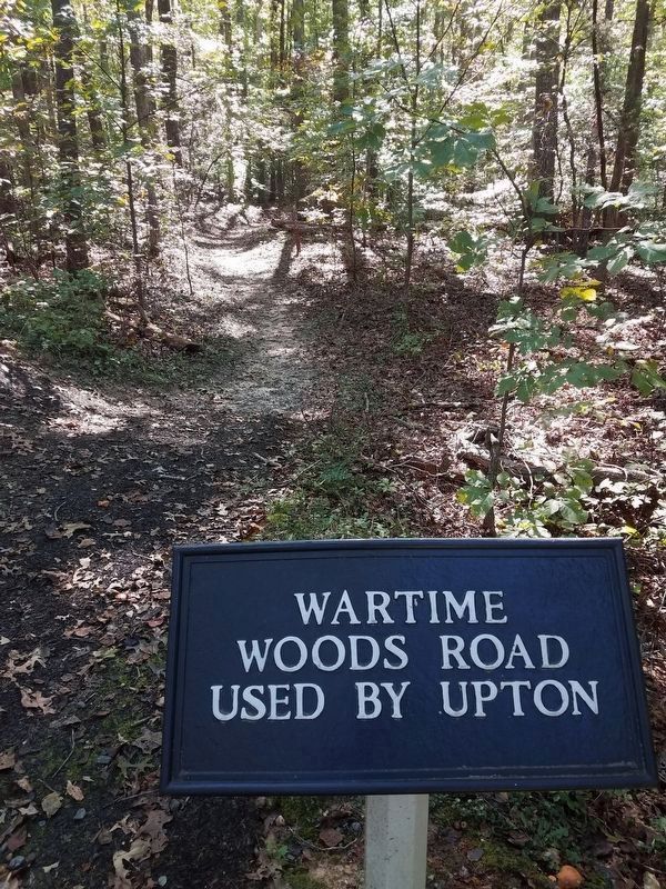
The road is now a foot trail which connects to Doles Salient.
Credits. This page was last revised on November 14, 2021. It was originally submitted on June 24, 2013, by Bernard Fisher of Richmond, Virginia. This page has been viewed 800 times since then and 39 times this year. Photos: 1, 2. submitted on June 24, 2013, by Bernard Fisher of Richmond, Virginia. 3. submitted on September 18, 2020, by Bradley Owen of Morgantown, West Virginia.
