Near Spotsylvania Courthouse in Spotsylvania County, Virginia — The American South (Mid-Atlantic)
The Muleshoe Salient
The Battle of Spotsylvania Court House
| — | Fredericksburg and Spotsylvania National Military Park | — |
Photographed by Bernard Fisher, June 23, 2013
1. The Muleshoe Salient Marker
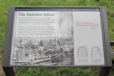
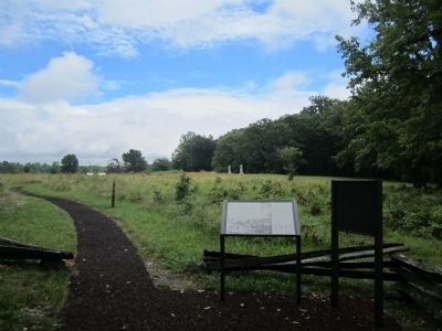
One hundred and fifty yards ahead of you is the Bloody Angle, perhaps the most hallowed site on any Civil War battlefield. The Bloody Angle is a small bend in the Confederate works within the much larger Muleshoe Salient, a huge outward bulge in the center of General Robert E. Lee’s six-mile long defensive line. For 22 hours on May 12 and May 13, 1864, combat raged here.
Confederate troops created the Muleshoe on the night of May 8, 1864, while attempting to weave together two lines of earthworks that ran at right angles to one another. Lee recognized that it was inherently weak—subject to Converging fire from many directions. To bolster the line, he constructed stout trenches, fortifying them with upwards of 30 cannon. Even so, the Salient remained his most vulnerable point—a fact bloodily demonstrated on May 12, 1864.
This is a wretched line. I do not see how it can be held!
General Robert E. Lee
May 9, 1864
(captions)
Salients, like the Muleshoe, subject their defenders to a deadly, converging crossfire.
In the event the enemy breaks through, defenders find themselves being attacked in both front
this page online
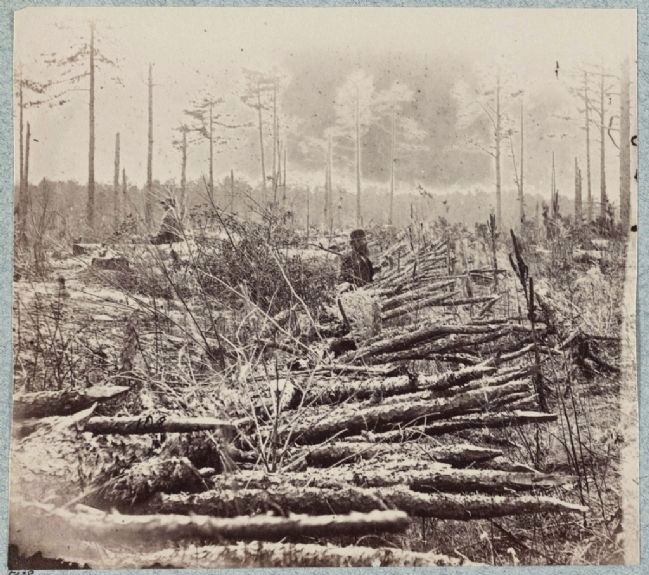
Fraises—sharpened branches like these—obstructed Union the advance on the Muleshoe Salient.
Erected by National Park Service, U.S. Department of the Interior.
Topics. This historical marker is listed in this topic list: War, US Civil. A significant historical month for this entry is May 1920.
Location. 38° 13.408′ N, 77° 36.079′ W. Marker is near Spotsylvania Courthouse, Virginia, in Spotsylvania County. It can be reached from Grant Drive north of Anderson Drive, on the left when traveling east. Touch for map. Marker is in this post office area: Spotsylvania VA 22553, United States of America. Touch for directions.

Regionally, this marker is in the Washington Metropolitan Area, in Northern Virginia, and in the Piedmont. It is also in the American South, specifically in the Upper South, in the Mid-Atlantic, and on the Eastern Seaboard. Globally, it is in the North Atlantic Region, North America, the Western Hemisphere, the Western World, and the Anglosphere. Historically, it finds itself in what was once the territory of the Mississippian Culture, one of the original Thirteen Colonies, one of the
Photographed by Bernard Fisher, June 23, 2013
2. The Muleshoe Salient Marker
Other nearby markers. At least 8 other markers are within walking distance of this marker: Attack on the Muleshoe (within shouting distance of this marker); Bloody Angle, Crowded Ravine (within shouting distance of this marker); Aftermath (within shouting distance of this marker); 49th New York Infantry (about 400 feet away); McGowan's Brigade (about 400 feet away); 126th Ohio Volunteer Infantry (about 400 feet away); 15th Regiment New Jersey Volunteers (about 400 feet away); The Confederate Earthworks (about 500 feet away). Touch for a list and map of all markers in Spotsylvania Courthouse.
Other markers no longer nearby. Spotsylvania Campaign (was a few steps from this marker but has been permanently removed); a different marker also named Spotsylvania Campaign (was about 300 feet away, measured in a direct line but has been permanently removed); a different marker also named Spotsylvania Campaign (was about 400 feet away but has been permanently removed); a different marker also named Spotsylvania Campaign (was about 500 feet away but has been permanently removed).
Photographed by G.O. Brown, circa 1865
3. Confederate entrenchments near 5035 (junction of old and new Court House Roads)
Library of Congress [LC-DIG-ppmsca-32879]
Also see . . . Fredericksburg & Spotsylvania National Military Park. National Park Service (Submitted on June 24, 2013.)
Credits. This page was last revised on November 14, 2021. It was originally submitted on June 24, 2013, by Bernard Fisher of Richmond, Virginia. This page has been viewed 1,905 times since then and 83 times this year. Photos: 1, 2. submitted on June 24, 2013, by Bernard Fisher of Richmond, Virginia. 3. submitted on June 24, 2013.
