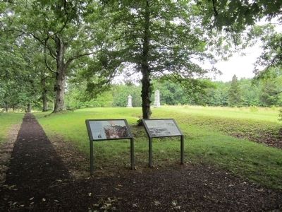
Near Spotsylvania Courthouse in Spotsylvania County, Virginia — The American South (Mid-Atlantic)
The Confederate Earthworks
The Battle of Spotsylvania Court House
ó Fredericksburg and Spotsylvania National Military Park ó
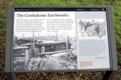
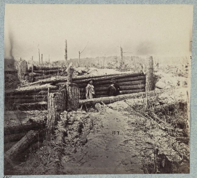
These modest mounds are all that remain of the Muleshoe Salientís once-formidable earthworks. Begun by the Confederates on the night of May 8, the works were four feet high, with a two-foot-deep trench. Dirt from the trench was thrown against the outer face of the logs to create a bulletproof barrier. As an added measure of safety, the defenders left a small gap beneath the top log through which they could fire without exposing their heads.
Because of the Salientís curved shape, Confederates here were exposed not only to bullets coming from the front but also from the sides. To protect themselves from enemy crossfire, they constructed a series of shorter barriers, called traverses, at right angles to the main line. Although the traverses have largely disappeared, evidence of them can still be seen in the rumpled contour of the ground.
They had felled timber and constructed excellent earthworks, somewhat after the style of building a log house with earth well thrown up in front. This line of fortifications was divided off, therefore, like stalls in a stable, the compartments being formed by the timbers which supported the other timbers, which with the earth constituted a splendid protection for the men behind them.
Lieutenant Harvey S. Wells, 84th Pennsylvania Volunteers
Walking on earthworks destroys them. Please help the National Park Service preserve these and other earthworks by remaining on the trail.
Erected by National Park Service, U.S. Department of the Interior.
Topics. This historical marker is listed in this topic list: War, US Civil. A significant day of the year for for this entry is May 8.
Location. 38° 13.415′ N, 77° 35.968′ W. Marker is near Spotsylvania Courthouse, Virginia, in Spotsylvania County. Marker can be reached from Grant Drive north of Anderson Drive, on the left when traveling east. Touch for map. Marker is in this post office area: Spotsylvania VA 22553, United States of America. Touch for directions.
Other nearby markers. At least 8 other markers are within walking distance of this marker. Struggle for the Bloody Angle (here, next to this marker); 15th Regiment New Jersey Volunteers (within shouting distance of this marker); "The Toughest Fight Yet" (within shouting distance of this marker); 49th New York Infantry (within shouting distance of this marker); Spotsylvania Campaign (within shouting distance of this marker); a different marker also named Spotsylvania Campaign (within shouting distance of this marker); McGowan's Brigade (within shouting distance of this marker); 126th Ohio Volunteer Infantry (about 400 feet away, measured in a direct line). Touch for a list and map of all markers in Spotsylvania Courthouse.
Also see . . . Fredericksburg & Spotsylvania National Military Park. National Park Service (Submitted on June 24, 2013.)
Credits. This page was last revised on November 14, 2021. It was originally submitted on June 24, 2013, by Bernard Fisher of Richmond, Virginia. This page has been viewed 721 times since then and 23 times this year. Photos: 1, 2. submitted on June 24, 2013, by Bernard Fisher of Richmond, Virginia. 3. submitted on June 24, 2013.


