Near Spotsylvania Courthouse in Spotsylvania County, Virginia — The American South (Mid-Atlantic)
Upton’s Assault
The Battle of Spotsylvania Court House
— Fredericksburg and Spotsylvania National Military Park —
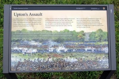
Just before 6 p.m. on May 10, 1864, 5,000 Union soldiers led by Colonel Emory Upton—formed in deep masses rather than traditional battle lines—emerged from the woods ahead of you and dashed across this field. They reached the main confederate line here.
Leaping over the works, they began stabbing with bayonets and swinging their muskets like clubs. More than 900 Confederate prisoners and four cannon (marked by the guns 80 yards to your left) fell into their hands. The victorious Federals swept down the works, widening the breach.
But no one had made arrangements to support the attack, and without more men Upton could go no farther. Meanwhile, in the fields behind you, Confederate generals marshaled troops to recapture the works. As daylight faded to darkness, Upton would be in for the fight of his life.
“The struggle lasted but a few seconds. Numbers prevailed, and, like a resistless wave, the column poured over the works…The column of assault had accomplished its task…The enemy’s lines were completely broken….” -Colonel Emory Upton, USA
(caption)
Upton’s attack, just before the Federals struck the Confederate works.
Erected by National Park Service, U.S. Department of the Interior.
Topics. This historical marker is listed in this topic list: War, US Civil. A significant historical month for this entry is May 1864.
Location. 38° 13.271′ N, 77° 36.212′ W. Marker is near Spotsylvania Courthouse, Virginia, in Spotsylvania County. Marker can be reached from Anderson Drive, 0.2 miles west of Grant Drive, on the right when traveling west. Touch for map. Marker is in this post office area: Spotsylvania VA 22553, United States of America. Touch for directions.
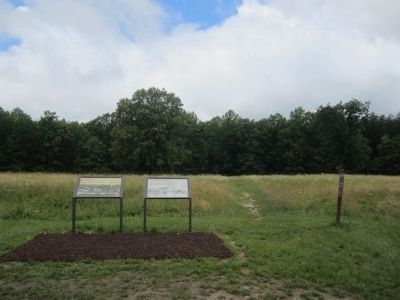
Other nearby markers. At least 8 other markers are within walking distance of this marker. Confederate Counterattack (here, next to this marker); Doles Salient (a few steps from this marker); Upton's Charge (about 400 feet away, measured in a direct line); Ramseur's Brigade (about 500 feet away); Spotsylvania Campaign (about 600 feet away); Forming for the Attack (about 600 feet away); a different marker also named Spotsylvania Campaign (approx. 0.2 miles away); McCoull Spring (approx. 0.2 miles away). Touch for a list and map of all markers in Spotsylvania Courthouse.
Also see . . . Fredericksburg & Spotsylvania National Military Park. National Park Service (Submitted on June 24, 2013.)
Credits. This page was last revised on November 14, 2021. It was originally submitted on June 24, 2013, by Bernard Fisher of Richmond, Virginia. This page has been viewed 584 times since then and 15 times this year. Photos: 1, 2. submitted on June 24, 2013, by Bernard Fisher of Richmond, Virginia.

