Natchitoches in Natchitoches Parish, Louisiana — The American South (West South Central)
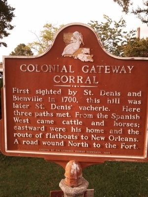
Colonial Gateway Corral
Erected 1968 by Louisiana Tourist Commission.
Topics. This historical marker is listed in these topic lists: Roads & Vehicles • Settlements & Settlers. A significant historical year for this entry is 1700.
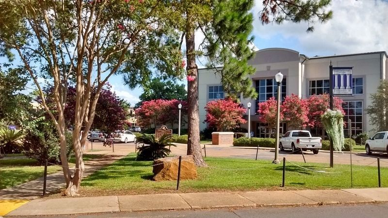
Location. 31° 44.936′ N, 93° 5.682′ W. Marker is in Natchitoches, Louisiana, in Natchitoches Parish. Marker is on Sam Sibley Drive near Central Ave.. On campus of Northwestern State University across street from NSU WRAC Building. Touch for map. Marker is in this post office area: Natchitoches LA 71457, United States of America. Touch for directions.
Other nearby markers. At least 8 other markers are within walking distance of this marker. Northwestern State University (approx. ¼ mile away); The American Cemetery (approx. 0.4 miles away); The Jefferson Highway (approx. 0.4 miles away); Fort St. Jean Baptiste (approx. 0.4 miles away); a different marker also named The American Cemetery (approx. 0.4 miles away); Fort Saint Jean Baptiste (approx. 0.4 miles away); El Camino Real de los Tejas (approx. 0.6 miles away); Natchitoches and the Early American Period (approx. 0.6 miles away). Touch for a list and map of all markers in Natchitoches.
Regarding Colonial Gateway Corral. "Vacherie" is French for a cow barn or cattle ranch.
Credits. This page was last revised on July 26, 2017. It was originally submitted on June 24, 2013, by Mike Waldon of Lafayette, Louisiana. This page has been viewed 722 times since then and 20 times this year. Photos: 1. submitted on June 24, 2013, by Mike Waldon of Lafayette, Louisiana. 2. submitted on July 25, 2017, by Tom Bosse of Jefferson City, Tennessee. • Bill Pfingsten was the editor who published this page.

