Hilton Head Island in Beaufort County, South Carolina — The American South (South Atlantic)
Fish Hall Plantation
⎯⎯⎯
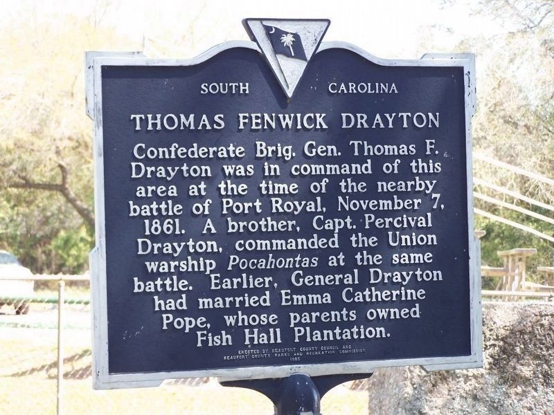
Thomas Fenwick Drayton

Photographed by Mike Stroud, March 6, 2011
1. Fish Hall Plantation side of marker
Thomas Fenwick Drayton. Confederate Brig. Gen. Thomas F. Drayton was in command of this area at the time of nearby battle of Port Royal, November 7, 1861. A brother, Capt. Percival Drayton, commanded the Union warship Pocahontas at the same battle. Earlier, General Drayton had married Emma Catherine Pope, whose parents owned Fish Hall Plantation.
Erected 1985 by Beaufort County Council. (Marker Number 7-18.)
Topics. This historical marker is listed in these topic lists: African Americans • Colonial Era • Notable Places. A significant historical year for this entry is 1717.
Location. 32° 14.732′ N, 80° 41.793′ W. Marker is on Hilton Head Island, South Carolina, in Beaufort County. It is on Fish Haul Road near Mitchelville Road, on the right
this page online

Regionally, this marker is in the Lowcountry and on the Sea Islands. It is also in the American South, specifically in the Deep South, and on the Eastern Seaboard. Globally, it is in the North Atlantic Region, North America, the Western Hemisphere, the Western World, and the Anglosphere. Historically, it finds itself in what was once New Spain, the territory of the Mississippian Culture, one of the original Thirteen Colonies, one of the Confederate States of America, and the Antebellum South.
Other nearby markers. At least 8 other markers are within walking distance of this marker: Mitchelville Site (approx. 0.8 miles away); Reconnecting with Family (approx. 0.8 miles away); Religion in Mitchelville/School in Mitchelville (approx. 0.8 miles away); Working for Wages / Freedmen’s Bureau (approx. 0.8 miles away); Mitchelville and Abolitionists (approx. 0.8 miles away); Cherry Hill School (approx. 0.8 miles away); Mitchelville Building Sites
Photographed by Mike Stroud, March 2008
2. Thomas Fenwick Drayton side of marker
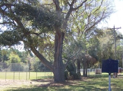
Regarding Fish Hall Plantation / Thomas Fenwick Drayton. Tabby is a building material, made from shells, lime, and water, which forms a sort of concrete. It was used for all sorts of structures, due to a shortage of brick.
Also see . . .
1. National Register Properties in South Carolina. The Fish Haul site represents the only known freedmen village established by occupying Union troops. Listed in the National Register June 30, 1988. ****note**** Limited access, not for general public (Submitted on March 26, 2008, by Mike Stroud of Bluffton, South Carolina.)
2. Battle of Port Royal. Port Royal Sound was defended by Fort Beauregard to the north, on Bay Point on Eddings Island, with 13 guns, and by Fort Walker on Hilton Head to the south, mounting 23 guns (although only 16 were operational in the battle). The forts were less than 3 miles apart across the Broad River, strongly built, and manned by gunners who had been alerted for over a week of the impending attack.
Photographed by Wikipedia
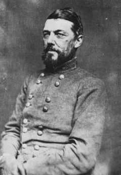
3. Gen. T.F. Drayton CSA
3. General Drayton. Drayton was an 1828 graduate of the United States Military Academy, where he was a classmate of Jefferson Davis, who became his lifelong friend. (Submitted on March 25, 2008, by Mike Stroud of Bluffton, South Carolina.)
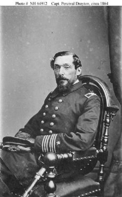
4. Capt. Drayton. Drayton was appointed a Midshipman in the Navy in December 1827 (Submitted on March 25, 2008, by Mike Stroud of Bluffton, South Carolina.)
5. USS Pocahontas. Pocahontas operated along the coasts of South Carolina, Georgia, and Florida, performing blockade duty, reconnoitering rivers and inlets, and supporting amphibious operations. She helped to capture Tybee Island Georgia 24 November (Submitted on March 25, 2008, by Mike Stroud of Bluffton, South Carolina.)
Photographed by Wikipedia
4. Capt. Percival Drayton, USN
Photographed by Mike Stroud, 2008
5. A" tabby" piece of structure seen in backround
Photographed by Mike Stroud, 2009
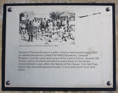
6. Fish Hall Plantation , From Interpretive sign, Port Royal Plantation, Hilton Head Island
General Drayton at Fish Hall Plantation in 1860.
General Thomas Drayton's wife's family had
owned since 1763 an island plantation called
Fish Hall Plantation. General Drayton, warden
and Vestryman of St. Luke's Parish, owned
102 slaves, many of whom joined the work
force of the Union establishment soon after
the Battle of Port Royal. Fish Hall Plantation
was located approximately ¾ of a mile north
from this point. [ site of Fort Walker; coordinates
32.232742 -80.677156 ]
Editor's Note: The photo pictured here was taken in May 1862 by photographer Henry P. Moore (1833-1911) and is available through the Gladstone Collection in the Library of Congress.
Editor's Note: The photo pictured here was taken in May 1862 by photographer Henry P. Moore (1833-1911) and is available through the Gladstone Collection in the Library of Congress.
Photographed by Mike Stroud, 2009
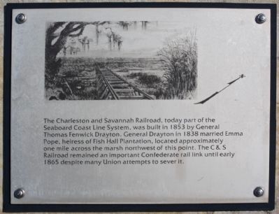
7. Fish Hall Plantation, part of Interpretive Marker at Fort Walker site, Port Royal Plantation
The Charleston and Savannah Railroad, today
part of the Seaboard Coast Line System, [ CSX]
was built in 1853 by General Thomas Fenwick
Drayton. General Drayton in 1838 married Emma
Pope, heiress of Fish Hall Plantation, located
approximately one mile across the marsh
northwest of this point. The C&S Railroad
remained an important Confederate rail link
until early 1865 despite many Union attempts
to sever it.
Photographed by Mike Stroud, 2009
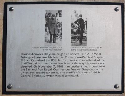
8. Thomas Fenwick Drayton ,from Interpretive marker at Ft.Walker site, Port Royal Plantation
Left- General Thomas F. Drayton,C.S.A .
at Fish Hall Plantation
Right- Commodore Percival Drayton, U.S.N. on the deck of the USS Hartford.
Thomas Fenwick Drayton, Brigadier General, C.S.A., a West Point graduate, and his brother, Commodore Percival Drayton, U.S.N., Captain of the USS Hartford, met at the outbreak of the Cival War, shook hands, and each went the way his conscience directed. On November 7, 1861, the brothers met in combat at the Battle of Port Royal. Commander Percival Drayton, on the Union gun boat Pocahontas, attacked Fort Walker of which General Thomas Drayton was in command.
[ site of Fort Walker; coordinates 32.232742 -80.677156 ]
Right- Commodore Percival Drayton, U.S.N. on the deck of the USS Hartford.
Thomas Fenwick Drayton, Brigadier General, C.S.A., a West Point graduate, and his brother, Commodore Percival Drayton, U.S.N., Captain of the USS Hartford, met at the outbreak of the Cival War, shook hands, and each went the way his conscience directed. On November 7, 1861, the brothers met in combat at the Battle of Port Royal. Commander Percival Drayton, on the Union gun boat Pocahontas, attacked Fort Walker of which General Thomas Drayton was in command.
[ site of Fort Walker; coordinates 32.232742 -80.677156 ]
Credits. This page was last revised on January 6, 2025. It was originally submitted on March 26, 2008, by Mike Stroud of Bluffton, South Carolina. This page has been viewed 7,196 times since then and 429 times this year. Photos: 1. submitted on March 6, 2011, by Mike Stroud of Bluffton, South Carolina. 2, 3, 4. submitted on March 25, 2008, by Mike Stroud of Bluffton, South Carolina. 5. submitted on March 26, 2008, by Mike Stroud of Bluffton, South Carolina. 6, 7, 8. submitted on February 10, 2009, by Mike Stroud of Bluffton, South Carolina. • Christopher Busta-Peck was the editor who published this page.
