
Near Elkton in Giles County, Tennessee — The American South (East South Central)
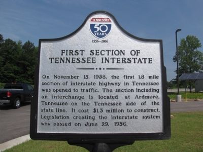
First Section of Tennessee Interstate
Photographed by Lee Hattabaugh, May 30, 2011
1. First Section of Tennessee Interstate Marker
Erected 2011 by State of Tennessee.
Topics. This historical marker is listed in this topic list: Roads & Vehicles. A significant historical month for this entry is June 1999.
Location. 35° 2.163′ N, 86° 52.71′ W. Marker is near Elkton, Tennessee, in Giles County. It can be reached from Interstate 65 at milepost 3, 1½ miles north of Old U.S. 31 (U.S. 31) when traveling north. Marker is located near the exit of the State of Tennessee visitor center. Touch for map. Marker is in this post office area: Ardmore TN 38449, United States of America. Touch for directions.

Regionally, this marker is in Middle Tennessee and in the Highland Rim. It is also in the American South and specifically in the Upper South. Globally, it is in North America, the Western Hemisphere, the Western World, and the Anglosphere.
this page online
Other nearby markers. At least 8 other markers are within 5 miles of this marker, measured as the crow flies: Civil War in Tennessee (within shouting distance of this marker); Tennessee Civil War Trails (within shouting distance of this marker); TDOT Welcome Center Pollinator Meadow (within shouting distance of this marker); Tennessee AMVETS Veterans Memorial (within shouting distance of this marker); Elkton Bridge (approx. 0.9 miles away); Montgomery and Parker Company Historic Bridge (approx. 0.9 miles away); John Calvin Brown (approx. 4.6 miles away); Neill S. Brown (approx. 4.6 miles away). Touch for a list and map of all markers in Elkton.
Photographed by Lee Hattabaugh, May 30, 2011
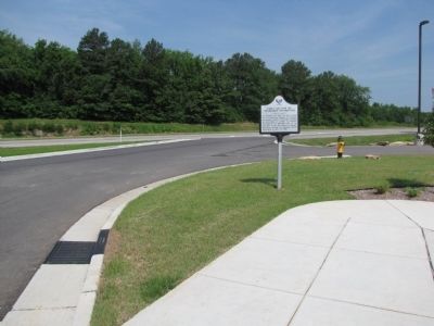
2. First Section of Tennessee Interstate Marker
Interstate 65 in the background.
Credits. This page was last revised on September 18, 2020. It was originally submitted on May 31, 2011, by Lee Hattabaugh of Capshaw, Alabama. This page has been viewed 910 times since then and 42 times this year. Last updated on June 25, 2013, by Lee Hattabaugh of Capshaw, Alabama. Photos: 1, 2. submitted on May 31, 2011, by Lee Hattabaugh of Capshaw, Alabama. • Bernard Fisher was the editor who published this page.
