Near Gulf Shores in Baldwin County, Alabama — The American South (East South Central)
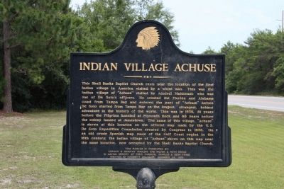
Indian Village Achuse
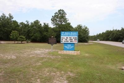
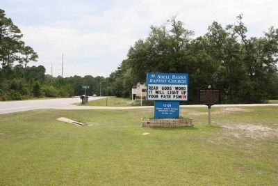
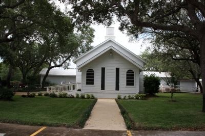
This Shell Banks Baptist Church rests near the location of the first Indian village in America visited by a white man. This was the Indian village of “Achuse” visited by Admiral Maldonado who was one of De Soto’s officers. He scouted the Florida and Alabama coast from Tampa Bay and entered the port of “Achuse” before De Soto started from Tampa Bay on the longest, strangest, boldest adventure in the history of the world. This was in 1539, 81 years before the Pilgrims kneeled at Plymouth Rock and 68 years before the colony landed at Jamestown. The name of this village, “Achuse” is shown at this location on the official map made by the U.S. De Soto Expedition Commission created by Congress in 1936. On an old crude Spanish map made of the Gulf Coast region in the 16th century, the Indian village of “Achuse” shows on this map near the same location, now occupied by the Shell Banks Baptist Church.
This Marker is presented by: Addison & Dorothy Mauldin and Milton & Ruth Ewing in Loving Memory of their parents, Charles & Sena Ewing. Written by Hatchett Chandler, December 23, 1966.
Erected 1966.
Topics. This historical marker is listed in these topic lists: Churches & Religion • Exploration • Native Americans. A significant historical date for this entry is December 23, 1843.
Location. 30° 15.104′ N, 87° 48.938′ W. Marker is near Gulf Shores, Alabama, in Baldwin County. Marker is on Alabama Route 180 east of Gasque Lane, on the right when traveling west. Touch for map. Marker is at or near this postal address: 12125 State Highway 180, Gulf Shores AL 36542, United States of America. Touch for directions.
Other nearby markers. At least 8 other markers are within 12 miles of this marker, measured as the crow flies. Vicinity of Salt Works and Camp Anderson (approx. 5.8 miles away); The Charles Swift Family / Swift Coles Historic Home (approx. 6.7 miles away); Camp Withers (approx. 7.3 miles away); Gulf Shores Community (approx. 7˝ miles away); Navy Cove / Pilot Town (approx. 8.9 miles away); Magnolia Springs, Alabama (approx. 10.7 miles away); The Springs (approx. 10.8 miles away); Romar Beach (approx. 11˝ miles away). Touch for a list and map of all markers in Gulf Shores.
Credits. This page was last revised on April 18, 2021. It was originally submitted on June 26, 2013, by Timothy Carr of Birmingham, Alabama. This page has been viewed 3,656 times since then and 179 times this year. Photos: 1, 2, 3, 4. submitted on June 26, 2013, by Timothy Carr of Birmingham, Alabama. • Bill Pfingsten was the editor who published this page.


