Central Waterford in New London County, Connecticut — The American Northeast (New England)
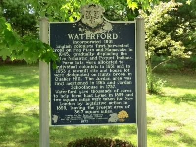
Waterford
Incorporated 1801
Farm lots were allocated to individual colonists in 1651 and in 1653 a sawmill site and house lot were designated on Hunts Brook in Quaker Hill. The Jordan area was first mentioned in 1663 and Jordan Schoolhouse in 1737.
Waterford gave thousands of acres to help form East Lyme in 1839 and two square miles were taken for New London by legislative action in 1899, leaving the present area of 36.7 square miles.
Erected 1975 by Town of Waterford, the Waterford Historical Society and the Connecticut Historical Commission.
Topics. This historical marker is listed in this topic list: Colonial Era. A significant historical year for this entry is 1645.
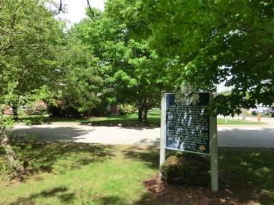
Location. 41° 20.683′ N, 72° 8.083′ W. Marker is in Waterford, Connecticut, in New London County. It is in Central Waterford. Marker is on Boston Post Road. Between Tiffany Avenue and Summer Street. Touch for map. Marker is in this post office area: Waterford CT 06385, United States of America. Touch for directions.
Other nearby markers. At least 8 other markers are within 2 miles of this marker, measured as the crow flies. Waterford Veterans Monument (approx. ¼ mile away); Agent Orange (approx. ¼ mile away); 75 Rope Ferry Road (approx. 0.4 miles away); Waterford Revolutionary War Memorial (approx. 0.4 miles away); Waterford Civil War Spanish American War Memorial (approx. 0.4 miles away); Waterford World War I Memorial (approx. 0.4 miles away); Margaret Delia Geary (approx. 1.4 miles away); Italian American Fountain (approx. 1.6 miles away). Touch for a list and map of all markers in Waterford.
Credits. This page was last revised on February 10, 2023. It was originally submitted on July 4, 2013, by Don Morfe of Baltimore, Maryland. This page has been viewed 457 times since then and 19 times this year. Photos: 1, 2. submitted on July 4, 2013, by Don Morfe of Baltimore, Maryland. • Bill Pfingsten was the editor who published this page.

