Old Saybrook in Lower Connecticut River Valley Region, Connecticut — The American Northeast (New England)
Old Saybrook
Qui Transtulit Sustinet
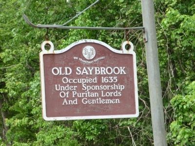
Photographed by Don Morfe, May 28, 2013
1. Old Saybrook Marker
Topics. This historical marker is listed in these topic lists: Colonial Era • Settlements & Settlers. A significant historical year for this entry is 1635.
Location. 41° 18.267′ N, 72° 22.383′ W. Marker is in Old Saybrook in Lower Connecticut River Valley Region, Connecticut. It is on Boston Post Road Place 0.2 miles east of Middlesex Turnpike. Touch for map. Marker is at or near this postal address: 14 Boston Post Rd Pl, Old Saybrook CT 06475, United States of America. Touch for directions.

Regionally, this marker is in the Connecticut River Valley, on the Connecticut Shoreline, and in Mystic and the Eastern Shore. It is also in the American Northeast, in New England, and on the Eastern Seaboard. Globally, it is in the North Atlantic Region, North America, the Western Hemisphere, the Western World, and the Anglosphere. Historically, it finds itself in what was once Middlesex County and also one of the original Thirteen Colonies.
Other nearby markers. At least 8 other markers are within 2 miles of this marker, measured as the crow flies: Old Saybrook World War I Monument
this page online
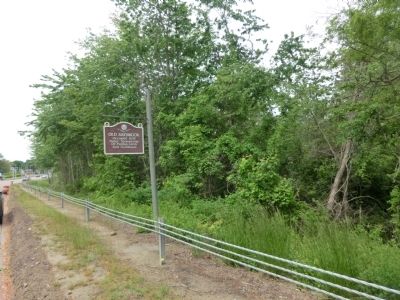
Photographed by Don Morfe, May 28, 2013
2. Old Saybrook Marker
Credits. This page was last revised on May 19, 2026. It was originally submitted on July 4, 2013, by Don Morfe of Baltimore, Maryland. This page has been viewed 680 times since then and 24 times this year. Photos: 1, 2. submitted on July 4, 2013, by Don Morfe of Baltimore, Maryland. • Bill Pfingsten was the editor who published this page.
