San Gabriel in Los Angeles County, California — The American West (Pacific Coastal)
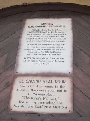
Mission San Gabriel Archangel / El Camino Real Door
Inscription.
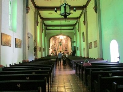
Founded September 8, 1771, by Franciscan Friars on Rio Temblores - due to flooding, the expedition moved to this 2nd site in 1774, where the Old Mission of stone and red brick was built with the help of Gabrieleno Indians.
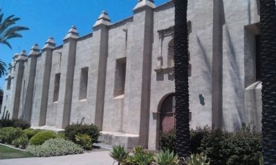
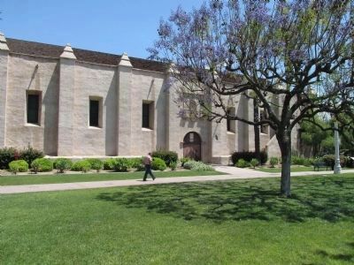
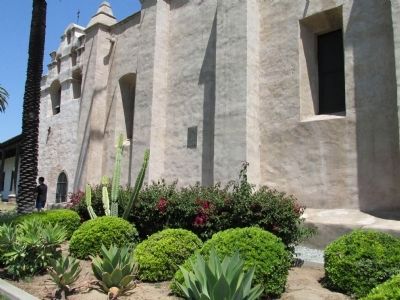
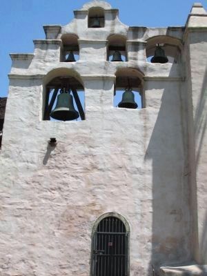
The exterior has exceptional beauty with its huge buttresses, massive bells in Campanario, built to replace the bell tower destroyed by the 1812 Earthquake.
Note - outside stairs to choir loft.
In 1781, "Los Pobladores" from the San Gabriel Mission founded in the Little Pueblo of Los Angeles.
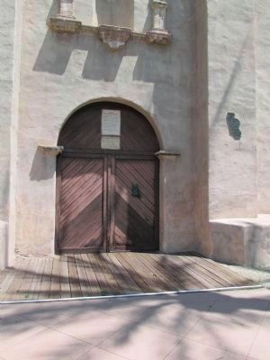
El Camino Real Door
The original entrance to the Mission, the doors open out to El Camino Real, "The King's Highway", the artery connecting the twenty-one California Missions.
Erected by San Gariel Mission.
Topics and series. This historical marker is listed in these topic lists: Churches & Religion • Roads & Vehicles. In addition, it is included in the El Camino Real, “The King's Highway” (California) series list. A significant historical month for this entry is September 1821.
Location. 34° 5.798′ N, 118° 6.407′ W. Marker is in San Gabriel, California, in Los Angeles County. Marker is on South Mission Drive, on the right when traveling north. Touch for map. Marker is at or near this postal address: 428 South Mission Drive, San Gabriel CA 91776, United States of America. Touch for directions.
Other nearby markers. At least 8 other markers are within walking distance of this marker. Lt. Colonel Juan Bautista de Anza (here, next to this marker); San Gabriel Mission (a few steps from this marker); Old Spanish Trail (a few steps from this marker); a different marker also named San Gabriel Mission (a few steps from this marker); Joseph Chapman’s Millrace (within shouting distance of this marker); 1776 Overland Immigration Expedition (within shouting distance of this marker); Chapman’s Mill and Millrace (within shouting distance of this marker); La Casa Vieja de Lopez (about 600 feet away, measured in a direct line). Touch for a list and map of all markers in San Gabriel.
Photographed By Denise Boose, May 1, 2013
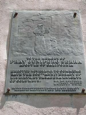
5. Memory of Fray Junipero Serra Marker
To the memory of Fray Junipero Serra Apostle of California. Erected Nov. 23, 1913, to commemorate the 200th Anniversary of his birth, by Pasadena Knights of Columbus.
B.J. MC Conville, Grand Knight.
H. Walter, D.G.K.
In the time of Rt. Rev. Thomas James Conaty, Bishop of Monterey and Los Angeles.
B.J. MC Conville, Grand Knight.
H. Walter, D.G.K.
In the time of Rt. Rev. Thomas James Conaty, Bishop of Monterey and Los Angeles.
Credits. This page was last revised on January 30, 2023. It was originally submitted on July 14, 2013, by Denise Boose of Tehachapi, California. This page has been viewed 834 times since then and 36 times this year. Photos: 1, 2, 3, 4, 5, 6, 7, 8, 9. submitted on July 14, 2013, by Denise Boose of Tehachapi, California. • Syd Whittle was the editor who published this page.
