Near Sharpsburg in Washington County, Maryland — The American Northeast (Mid-Atlantic)
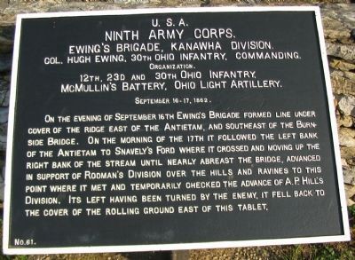
Ninth Army Corps
Ewing's Brigade, Kanawha Division
Ninth Army Corps
Ewing's Brigade, Kanawha Division.
Col. Hugh Ewing, 30th Ohio Infantry, Commanding.
Organization.
12th, 23d and 30th Ohio Infantry,
McMullin's Battery, Ohio Light Artillery.
September 16-17, 1862.
On the evening of September 16th Ewing's Brigade formed line under cover of the ridge east of the Antietam, and southeast of the Burnside Bridge. On the morning of the 17th it followed the left bank of the Antietam to Snavely's Ford where it crossed and moving up the right bank of the stream until nearly abreast the bridge, advanced in support of Rodman's Division over the hills and ravines to this point where it met and temporarily checked the advance of A.P. Hill's Division. Its left having been turned by the enemy, it fell back to the cover of the rolling ground east of this tablet.
Erected by Antietam Battlefield Board. (Marker Number 61.)
Topics and series. This historical marker is listed in this topic list: War, US Civil. In addition, it is included in the Antietam Campaign War Department Markers series list. A significant historical date for this entry is September 17, 1862.
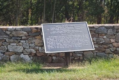
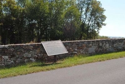
Location. 39° 26.955′ N, 77° 44.445′ W. Marker is near Sharpsburg, Maryland, in Washington County. Marker is on Branch Avenue, on the left when traveling south. Touch for map. Marker is in this post office area: Sharpsburg MD 21782, United States of America. Touch for directions.
Other nearby markers. At least 10 other markers are within walking distance of this marker. 30th Ohio Volunteer Infantry (within shouting distance of this marker); Archer's Brigade (within shouting distance of this marker); 23rd Ohio Infantry (about 400 feet away, measured in a direct line); Rodman's Division, Ninth Army Corps (about 500 feet away); Brigadier General L. O'B. Branch (about 500 feet away); a different marker also named Ninth Army Corps (about 500 feet away); Branch's Brigade (about 500 feet away); Battery E, 4th U.S. Artillery (about 500 feet away); Battery E, 2nd U.S. Artillery (about 600 feet away); Battery G, 4th U.S. Artillery (about 600 feet away). Touch for a list and map of all markers in Sharpsburg.
Also see . . .
1. Antietam Battlefield. National Park Service site. (Submitted on March 27, 2008, by Craig Swain of Leesburg, Virginia.)
2. 1st Brigade, Kanawha Division, IX Corps. The brigade was commanded by Col. Eliakim Parker Scammon at the onset of the campaign. Scammon was replaced by Col. Hugh Ewing when the former assumed command of the Division. Ewing went on to command his own Division at the battle of Chattanooga and later through the Carolinas Campaign.
Photographed By Craig Swain, February 9, 2008
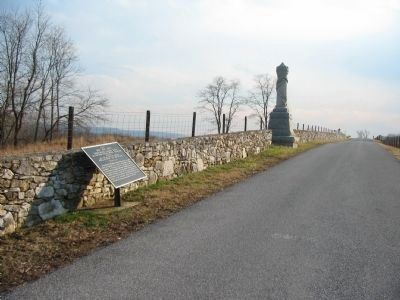
2. Ewing's Brigade Tablet and 30th Ohio Infantry Monument
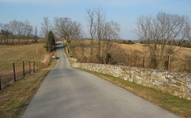
The 23rd and 30th Ohio Infantry Regiments formed along the stone wall in this vicinity from around 4 p.m. to 5 p.m. on the afternoon of September 17. The current stone wall is a reproduction of the original.
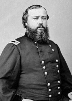
3. Hugh Boyle Ewing. Hugh Boyle Ewing, (October 31, 1826 – June 30, 1905), was a diplomat, author, attorney, and Union Army general during the American Civil War. He was a member of the prestigious Ewing family, son of Thomas Ewing, the eldest brother of Thomas Ewing, Jr. and Charles Ewing, and the foster brother and brother-in-law of William T. Sherman. (Submitted on October 11, 2015, by Brian Scott of Anderson, South Carolina.)
Photographed By Brian Scott
5. Brig. General Hugh Boyle Ewing (1825-1905)
At Antietam his brigade was placed upon the extreme left of the army, where, according to the report of the commander of the left wing, General Ambrose Burnside, by a brilliant change of front he saved the left from being completely driven in.
Photographed By Craig Swain, February 9, 2008
6. Ewing's Brigade Checks the Confederate Counterattack
Looking north down Branch Avenue. The 23rd and 30th Ohio held the line here to temporarily check the Confederate counterattacks on the afternoon of the battle. At around 5 p.m. the two regiments occupied positions on either side of the ravine bisected by the stone wall. Branch Avenue parallels the position of the original wall and a reproduction lines the east side of the road.
Credits. This page was last revised on November 24, 2017. It was originally submitted on March 27, 2008, by Craig Swain of Leesburg, Virginia. This page has been viewed 828 times since then and 16 times this year. Photos: 1, 2. submitted on March 27, 2008, by Craig Swain of Leesburg, Virginia. 3, 4, 5. submitted on October 11, 2015, by Brian Scott of Anderson, South Carolina. 6. submitted on March 27, 2008, by Craig Swain of Leesburg, Virginia.
