West Harrison in Dearborn County, Indiana — The American Midwest (Great Lakes)
Morgan's Great Raid
Six Days of Terror
— John Hunt Morgan Heritage Trail —
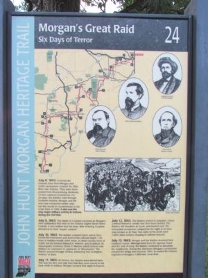
July 8, 1863. Confederate General John Hunt Morgan and 2,000 cavalrymen crossed the Ohio River into Indiana. They were transported from Brandenburg, Kentucky, on two captured steamboats. For six days, the Raiders rode through Southern Indiana. Morgan and his men had conducted earlier raids, but this would be remembered as his Great Raid of 1863. It also was the only major military activity in Indiana during the Civil War.
July 9, 1863. The Battle of Corydon occurred as Morgan's men outflanked 450 men of the Indiana Legion (local Home Guards). It was written that the men, after entering Corydon, plundered to their "hearts' content."
July 10, 1863. The Raiders entered Salem where they looted the businesses and burned the railroad depot—no town in Indiana would suffer more. A Union cavalry force of 4,000, led by General Edward H. Hobson, was in pursuit. At Indianapolis, Governor Oliver P. Morton asked General Lew Wallace to command 13 regiments of "Minutemen." The Raiders passed through Vienna, advancing into Lexington, Indiana, at dusk.
July 11, 1863. At Vernon, the Raiders were turned back. This was the first and only time that they were forced to fall back while in Indiana. Morgan camped that night in Dupont.
July 12, 1863. The Raiders arrived in Versailles. Union General Hobson's cavalry was four hours behind. The Raiders left Versailles at 4 p.m. and headed east. The exhausted cavalrymen camped for the night in an area now known as St. Paul. Two miles to the north were 1,800 Union soldiers sleeping in railroad boxcars.
July 13, 1863. Morgan and the Raiders resumed their eastward course. Although tired from the rigorous travel and the lack of sleep, the Raiders continued to devastate the countryside. During the afternoon, Morgan's cavalrymen crossed the bridge into Harrison, Ohio. So ended the Indiana segment of Morgan's 1,000-mile Great Raid. (Marker Number 24.)
Topics and series. This historical marker is listed in this topic list: War, US Civil. In addition, it is included in the John Hunt Morgan Heritage Trail in Indiana series list. A significant historical month for this entry is July 1863.
Location. 39° 15.413′ N, 84° 49.21′ W. Marker is in West Harrison, Indiana, in Dearborn County. Marker is on S. State Street south of Mill Street, on the right when traveling south. Touch for map. Marker is at or near this postal address: 515 S State Street, West Harrison IN 47060, United States of America. Touch for directions.
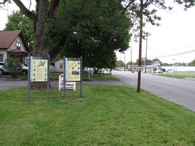
Other nearby markers. At least 8 other markers are within walking distance of this marker. When the Civil War Came to Indiana (here, next to this marker); High Water Mark (approx. 0.4 miles away); General John Morgan (approx. 0.4 miles away);
Harrison (approx. 0.4 miles away in Ohio); P.F.C. William B. Baugh, U.S.M.C. (approx. 0.4 miles away in Ohio); Harrison War Memorial (approx. 0.4 miles away in Ohio); Canal Junction (approx. 0.4 miles away); Morgan's Raiders Enter Ohio (approx. 0.6 miles away). Touch for a list and map of all markers in West Harrison.
More about this marker. The marker is the 24th and last interpretive sign on the John Hunt Morgan Heritage Trail.
Also see . . . John Hunt Morgan Heritage Trail. From the Historic Hoosier Hills RC&D website. (Submitted on May 29, 2014, by Duane Hall of Abilene, Texas.)
Credits. This page was last revised on June 16, 2016. It was originally submitted on July 20, 2013, by Duane Hall of Abilene, Texas. This page has been viewed 1,272 times since then and 50 times this year. Photos: 1, 2. submitted on July 20, 2013, by Duane Hall of Abilene, Texas. • Bill Pfingsten was the editor who published this page.

