Near Glasgow in Amherst County, Virginia — The American South (Mid-Atlantic)
The Courage of Frank Padget
Photographed by Roger Dean Meyer, August 30, 2008
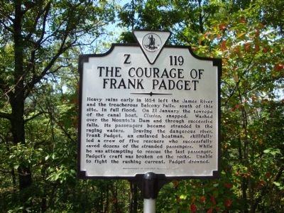
1. The Courage Of Frank Padget Marker
Heavy rains early in 1854 left the James River and the treacherous Balcony Falls, south of this site, in full flood. On 21 January the towrope of the canal boat, Clinton, snapped. Washed over the Mountain Dam and through successive falls, its passengers became stranded in the raging waters. Braving the dangerous river, Frank Padgett, an enslaved boatman, skillfully led a crew of five rescuers who successfully saved dozens of the stranded passengers. While he was attempting to rescue the last passenger, Padgett’s craft was broken on the rocks. Unable to fight the rushing current, Padgett drowned.
Erected 2007 by Department of Historic Resources. (Marker Number Z-119.)
Topics and series. This historical marker is listed in these topic lists: African Americans • Disasters • Industry & Commerce • Waterways & Vessels. In addition, it is included in the Virginia Department of Historic Resources (DHR) series list. A significant historical year for this entry is 1854.
Location. Marker has been permanently removed. It was located near 37° 36.433′ N, 79° 25.85′ W. Marker was near Glasgow, Virginia, in Amherst County.
this page online
We have been informed that this marker is no longer there and will not be replaced. This page is an archival view of what was.
Regionally, this marker was in Central Virginia. It was also in the American South and specifically in the Upper South. Globally, it was in North America, the Western Hemisphere, the Western World, and the Anglosphere. Historically, it found itself in what was once the territory of the Mississippian Culture, one of the original Thirteen Colonies, one of the Confederate States of America, and the Antebellum South.

Other nearby markers. At least 8 other markers are within 5 miles of this location, measured as the crow flies: Amherst County / Rockbridge County (here, next to this marker); Indian and Settler Conflict (approx. 1.8 miles away); Frank Padget (approx. 2.1 miles away); Frank Padget Water Tragedy (approx. 2.1 miles away); Water Gap (approx. 5 miles away); Battery Creek Lock
Photographed by Roger Dean Meyer
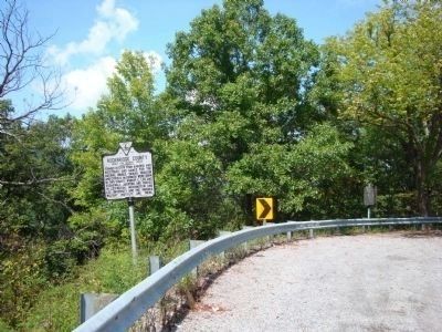
2. View of with Courage Of Frank Padgett Marker with Amherst/Rockbridge County Marker.
Viewed from Highway 501 with Amherst/Rockbridge County Marker in foreground.
Credits. This page was last revised on August 3, 2026. It was originally submitted on July 22, 2013, by Roger Dean Meyer of Yankton, South Dakota. This page has been viewed 1,723 times since then and 80 times this year. Photos: 1, 2. submitted on July 22, 2013, by Roger Dean Meyer of Yankton, South Dakota.
