
Lincoln in Lancaster County, Nebraska — The American Midwest (Upper Plains)
Lincoln Army Air Field
⎯⎯⎯
Lincoln Air Force Base
Photographed by Duane Hall, July 8, 2013
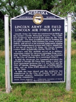
1. Lincoln Army Air Field - Lincoln Air Force Base Marker
Lincoln Army Air Field was constructed in 1942 on the former Lincoln Municipal Airport. The 2,750-acre property was leased to the army by the City of Lincoln. The base provided technical training for aircraft mechanics, basic training for army aviation cadets, and served as an overseas deployment staging area for bombardment groups and fighter squadrons. It was one of eleven U.S. Army Air Forces training centers built in Nebraska during World War II.
At war's end the airfield served as a military separation center for aircrews returning from overseas. It closed in December 1945 and was returned to the City of Lincoln for a municipal airport.
In 1952 the Strategic Air Command activated the airfield as Lincoln Air Force Base under a joint-use lease agreement between the U.S. Air Force and the City of Lincoln. Bomber wings, air refueling squadrons, and an Atlas ICBM squadron were assigned to the base.
In 1966 the base closed and the property was transferred to the City of Lincoln for use as a municipal airport, industrial park, and public housing community.
Erected by Lincoln Airport Authority, Preservation
this page online
Topics and series. This historical marker is listed in these topic lists: Air & Space • War, Cold • War, World II. In addition, it is included in the Nebraska State Historical Society series list. A significant historical month for this entry is December 1945.
Location. 40° 51.834′ N, 96° 46.974′ W. Marker is in Lincoln, Nebraska, in Lancaster County. It can be reached from the intersection of NW 44th St and W. Cuming St. Marker is located at Bowling Lake Park in the parking lot accessed from NW 44th St. Touch for map. Marker is in this post office area: Lincoln NE 68524, United States of America. Touch for directions.

Regionally, this marker is in the American Midwest, in the Corn Belt, and on the prairies. Globally, it is in North America, the Western Hemisphere, the Western World, and the Anglosphere. Historically, it finds itself in what was once the Louisiana Purchase.
Other nearby markers. At least 8 other markers are within 5 miles of this marker, measured as the crow flies: Lincoln Army Air Field Regimental Chapel (approx. 0.3 miles
Photographed by Duane Hall, July 8, 2013
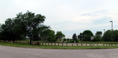
2. Lincoln Army Air Field - Lincoln Air Force Base Marker
Also see . . . Lincoln Air Force Base Online Museum. (Submitted on July 23, 2013, by Duane Hall of Abilene, Texas.)
Photographed by Duane Hall, July 8, 2013
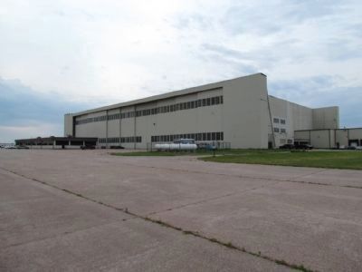
3. North Double-Cantilever Hangar
Credits. This page was last revised on September 27, 2024. It was originally submitted on July 23, 2013, by Duane Hall of Abilene, Texas. This page has been viewed 1,519 times since then and 83 times this year. Photos: 1, 2, 3. submitted on July 23, 2013, by Duane Hall of Abilene, Texas. • Bill Pfingsten was the editor who published this page.
