Near Sharpsburg in Washington County, Maryland — The American Northeast (Mid-Atlantic)
Rodman's Division, Ninth Army Corps
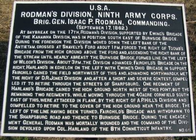
Rodman's Division, Ninth Army Corps.
Brig. Gen. Isaac P. Rodman, Commanding.
(September 17, 1862.)
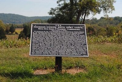
At daybreak on the 17th, Rodman's Division, supported by Ewing's Brigade of the Kanawha Division, was in position south east of Burnside Bridge. During the forenoon the Division moved down the left bank of the Antietam, crossed at Snavely's Ford about 1 p.m., forced the right of Toomb's Brigade from the high ground above the ford and, ascending the right bank of the stream until nearly abreast the Burnside Bridge, formed line on the left of Wilcox's Division. About 3 p.m., the Division advanced; Fairchild's Brigade on the right, Harland's in echelon on the left with Ewing's Ohio Brigade in support. Fairchild gained the field northwest of this and, advancing northwardly, met the right of D.R. Jones' Division and, after a short and severe contest, compelled it to retire through the streets of Sharpsburg. One regiment of Harland's Brigade gained the high ground north west of this point; but the remaining two regiments, while moving through the 40 acre cornfield south east of this, were attacked in flank, by the right of A.P. Hill's Division and compelled to retire to the cover of the high ground near the bridge. The left of the line having been turned, Fairchild's Brigade was withdrawn to the Sharpsburg Road and thence to Burnside Bridge. During the engagement General Rodman was mortally wounded and the command of the Division devolved upon Col. Harland of the 8th Connecticut Infantry.
Erected by Antietam Battlefield Board. (Marker Number 65.)
Topics and series. This historical marker is listed in this topic list: War, US Civil. In addition, it is included in the Antietam Campaign War Department Markers series list. A significant historical date for this entry is September 17, 1862.
Location. 39° 26.88′ N, 77° 44.472′ W. Marker is near Sharpsburg, Maryland, in Washington County. Marker is on Branch Avenue, on the left when traveling south. Touch for map. Marker is in this post office area: Sharpsburg MD 21782, United States of America. Touch for directions.
Other nearby markers. At least 10 other markers are within walking distance of this marker. Brigadier General L. O'B. Branch (a few steps from this marker); Ninth Army Corps (a few steps from this marker); Battery E, 4th U.S. Artillery (a few steps from this marker); Battery E, 2nd U.S. Artillery (within shouting distance of this marker); Battery G, 4th U.S. Artillery (within shouting distance of this marker); Battery A, 5th U.S. Artillery (within shouting distance of this marker); Jackson's Command (within shouting distance of this marker); Archer's Brigade (about 300 feet away, measured in a direct line); 30th Ohio Volunteer Infantry (about 300 feet away); a different marker also named Ninth Army Corps (about 500 feet away). Touch for a list and map of all markers in Sharpsburg.
Related markers. Click here for a list of markers that are related to this marker. Rodman's (3rd) Division IX Corps Markers
Also see . . .
1. Antietam Battlefield. National Park Service site. (Submitted on March 27, 2008, by Craig Swain of Leesburg, Virginia.)
2. 3rd Division, IX Corps. Rodman hailed from Rhode Island and was a merchant and politician before the war. (Submitted on March 27, 2008, by Craig Swain of Leesburg, Virginia.)
3. Isaac P. Rodman. Isaac Peace Rodman (August 18, 1822 – September 30, 1862) was a Rhode Island banker and politician, and a Union Army brigadier general in the American Civil War, mortally wounded at the Battle of Antietam. (Submitted on October 11, 2015, by Brian Scott of Anderson, South Carolina.)
Photographed By Craig Swain, February 9, 2008
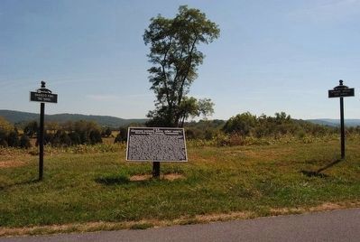
3. Signposts Flank the Rodman's Division Tablet
On the left a signpost indicates Snavely's ford is 780 yards southwest of the tablet location. On the right another points to the Burnside Bridge, almost due east at 650 yards. Notice the shaft of the 16th Connecticut Monument in the background.
Photographed By Brian Scott
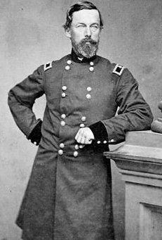
5. Brig. General Isaac P. Rodman (1822-1862)
Sighting the approaching Confederates, Rodman knew his division, on the Union army's left flank, would take the brunt of their assault. Galloping across a cornfield to warn his brigade commanders, he was shot through the left lung, mortally wounded. He died thirteen days later in a field hospital at Sharpsburg.
Photographed By Craig Swain
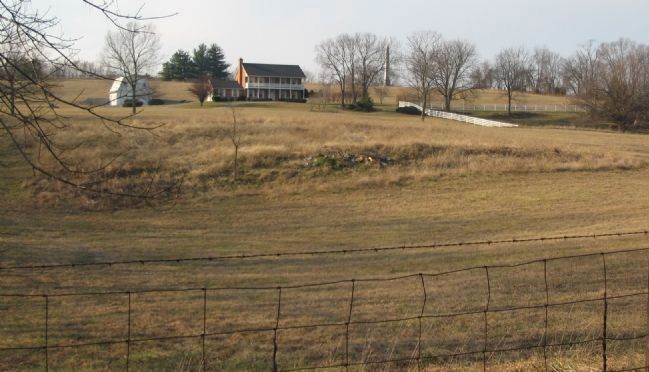
6. Fairchild's Brigade Advances on Sharpsburg
From Branch Avenue looking west. Fairchild's Brigade advanced to the west and over the high ground overlooking Sharpsburg. The Brigade's furthest advance is close to the location of the 9th New York Monument, the shaft of which is seen on the high ground behind the house.
Photographed By Craig Swain, February 9, 2008
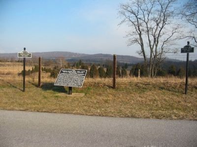
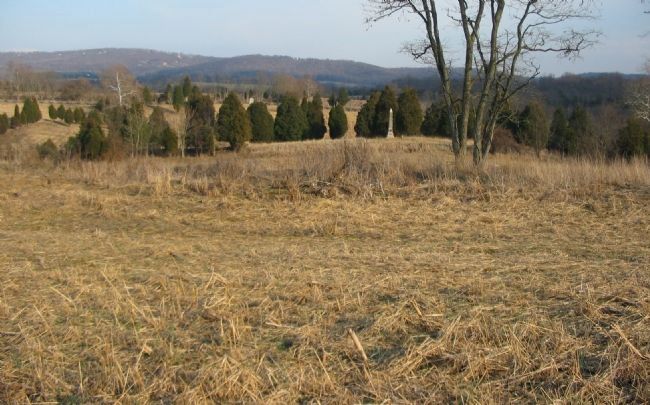
7. Harland's Brigade Advances
Looking east from Branch Avenue, near the tablet location. Harland's Brigade advanced on the left of Fairchild's and slightly to the rear, in echelon. Harland's entered the forty acre cornfield, which stood between the Otto farm lane (along the snake rail fence in the distance) and what is today Branch Avenue. The 16th Connecticut Monument (obelisk in the center of this photo) stands in the middle of the field. Harland's Brigade was attacked by portions of A.P. Hill's Confederate Division while crossing the field.
Credits. This page was last revised on November 24, 2017. It was originally submitted on March 27, 2008, by Craig Swain of Leesburg, Virginia. This page has been viewed 968 times since then and 18 times this year. Photos: 1. submitted on March 27, 2008, by Craig Swain of Leesburg, Virginia. 2. submitted on October 11, 2015, by Brian Scott of Anderson, South Carolina. 3. submitted on March 27, 2008, by Craig Swain of Leesburg, Virginia. 4, 5. submitted on October 11, 2015, by Brian Scott of Anderson, South Carolina. 6, 7. submitted on March 28, 2008, by Craig Swain of Leesburg, Virginia.
